
Waterfall Hwy, Oregon Travel - Waterfall Hwy 138 & Mysterious Volcano Pt 1
Waterfall Highway 138 may be the most scenic drive in OR. It hugs the N. Umpqua River with 24 gorgeous waterfalls, like Toketee Falls. Drive thru the Cascade M:ountains to Crater Lake, the 7th deepest in the world that sits inside a volcano. Visit the spires & learn about it's mysterious past. A bucket list must.
Plan 5-8 days total, Part 1-2. Total route = Interstate 5 in Roseburg, along Waterfall Hwy 138 to Crater Lake and back to Interstate 5 in Medford.
Perfect add-on trip: Any Closer & You'll Be Lunch
Waterfall Hwy 138 might just be the most scenic drive in Oregon. The road follows the N. Umpqua River in glistening shades of blues & greens as it winds thru lush green forests and dark rocky cliffs. It's jaw-dropping gorgeous and one of my favorite places to visit. The hikes are both exhilarating & peaceful.
For Part's 1 and 2 - we'll focus on the area between Glide, OR and Watson Falls in Idleyld Park, OR before heading on to Crater Lake. Within this 45 mile stretch of Waterfall Highway 138 - there are 24 beautiful waterfalls. I've included waterfalls within a 1 hour's drive off Waterfall Hwy 138.
Waterfall Hwy 138, Oregon
Glide & Colliding Rivers
Location = Colliding Rivers in Glide, OR. From Roseburg, head east on 138 for about 16 miles. Go left on Glide Loop Dr, and immediately left into the parking lot.
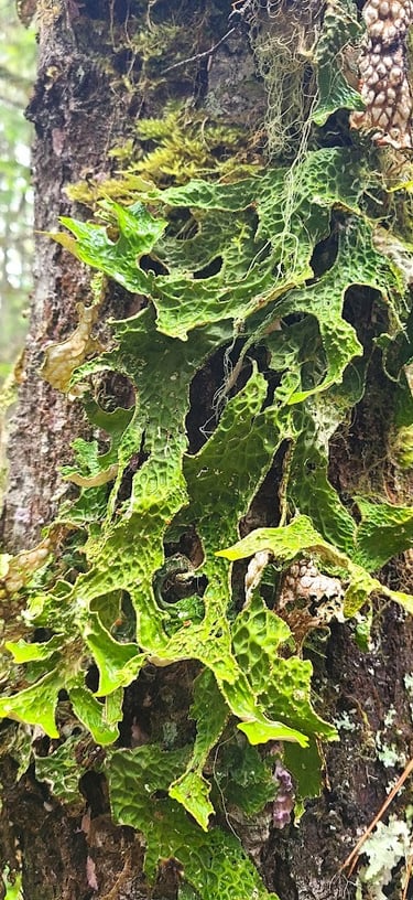
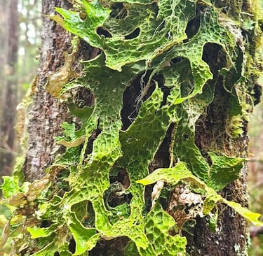
You don't have to stop here, but it's a nice little spot to stretch your legs for a minute & let the dogs do their business before we head off to our first waterfall. Colliding Rivers has a short trail north of the parking lot. Along the river bank you'll find some interesting artwork - green mossy designs courtesy of mother nature on many of the trees.
Time to pile back in the car and start with a 1/2 day detour south of Waterfall Hwy 138.
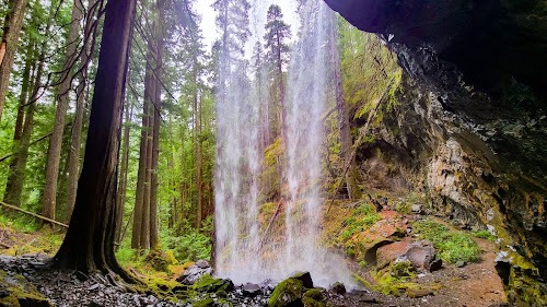
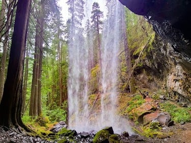
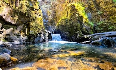
Grotto Falls
Location = Grotto Falls. Head back to NF-2701 and go left. Stay left when NF-020 splits off, then right on Little River Rd. Just past Coolwater Campground, go left on NF-2703. Keep following it thru twists & turns. When the road splits, stay left on NF-150 for 2.1 miles to Grotto Falls trail.
Grotto Falls is a short trail, but the falls have a mystical quality because of the extra viewpoint. Grotto Falls is my favorite type of waterfall because I love walking behind the falls.
A couple years back, I was at a waterfall with a fairly decent size cave that went back maybe 30 feet. Gotta say....it's a little creepy to hear a sound from somewhere in the dark recesses of a cave in the middle of NO-where.
I tried to convince myself it was a squirrel - but it sure sounded like it came from something bigger than a little furball to make. I mean, I really prefer to stay off the menu!
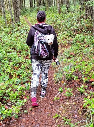
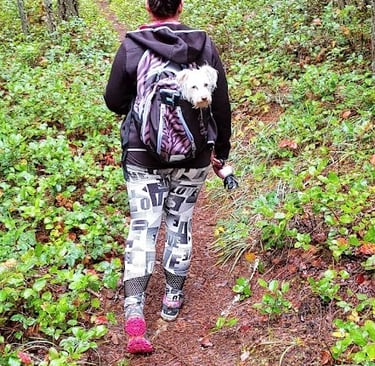

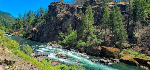
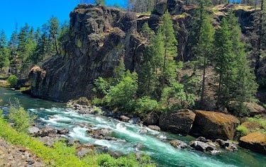
Location = Wolf Creek Falls. From Hwy 138 at Colliding Rivers, go south on Little River Rd for 12.9 miles. Right on NF-2701 for 2 miles, then right for .7 mile to the falls. The trail at Wolf Creek starts across the footbridge.
Wolf Creek Falls is 2.4 miles roundtrip. The first half is easy, but then starts up a slightly steep incline. Secluded in the forest is the 2 tier waterfall which drops a total of 125 feet. The creek water that runs along the trail changes shades.
My daughter took a turn carrying my fur baby, Benny. I could tell his arthritic back started slowing him down after about 1/2 mile. He loves exploring just as much as I do - so I just can't leave him behind.
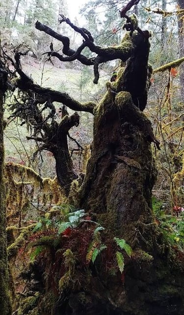
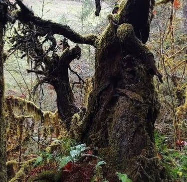
Check out this creepy tree on the way to Wolf Creek Falls. It looks like it belongs in the story of Ichabod Crane and the Headless Horseman.
Yeah...that's one spooky looking tree, especially if you walked past at dusk.
Wolf Creek Falls
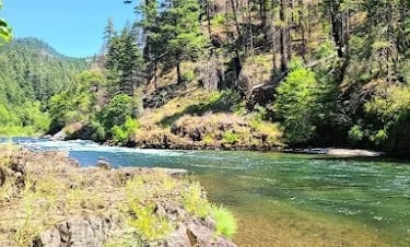
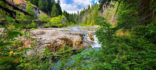
Look What's Coming.... Waterfall Hwy 138
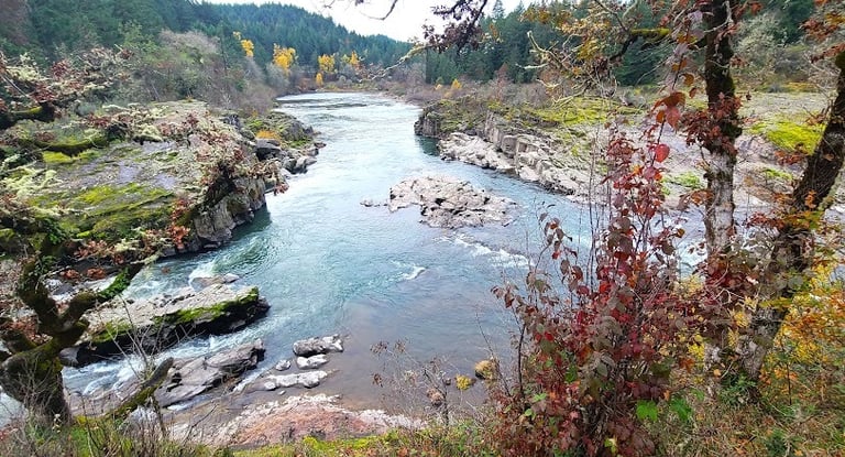
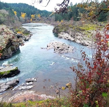
Head back to Colliding Rivers, but before turning right on Hwy 138 - take a peek below at what's coming up. Now you can see why this highway of waterfalls might just be the most scenic drive in Oregon - purely nature, totally gorgeous, and an amazing display of a perfect Creation.
These photo's were taken right off the road. We'd find the closest turnout or spot big enough to park and walk to these viewpoints. I promise: it's even more stunning in person.
Deadline Falls
Location = Deadline Falls. 22 mile marker on Hwy 138, OR.
Deadline Falls is 1/4 mile easy roundtrip hike. It’s not a jaw-dropper but totally worth the stop when the salmon are swimming upstream. They travel all the way from the Pacific Ocean up the Umpqua River, about 96 miles by car between May & September.
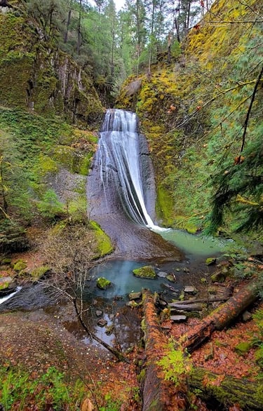
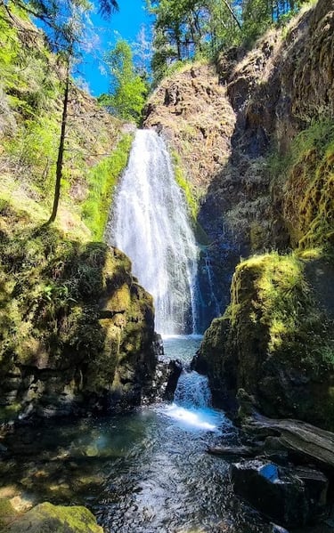
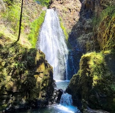
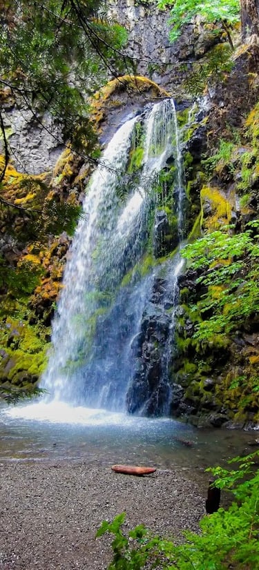
Location = Susan Creek Falls. 28.2 mile marker on Hwy 138, OR. Park at the Day Use area on the right.
Susan Creek Falls is across the street and it's an easy 1.6 mile roundtrip hike. Watch for the educational signs on the trail describing the trees & plant life. Susan Creek Campground is also just up the road on the right and allows horseback riding, fly-fishing, biking, and hiking.
As you approach Susan Creek Falls, you’ll be greeted by a 50 foot waterfall which plummets over the volcanic rock into a fairly big pool. The overflowing water is then pushed thru a narrow opening creating a baby, 2 foot fall.
The larger pool in back is perfect for cooling off on hotter days. We'd been hiking pretty much non-stop for several hours, and needed a cool down so we took the plunge.
Fall Creek Falls
Location = Fall Creek Falls. 32 mile marker on Hwy 138, OR.
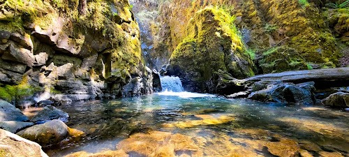
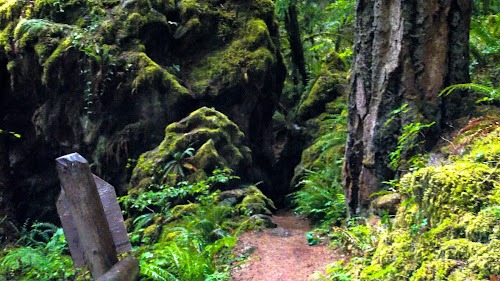
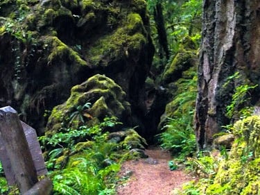
Fall Creek Falls is 2 miles roundtrip to a multi-tiered waterfall. Did the trail just dead-end? I mean.... it just disappears into a boulder shrouded by moss and tree limbs. Is it a cave or maybe a tunnel? You find out. The whole scene looks like a creepy Halloween setting, including a tombstone, see photo below.
At the base of Fall Creek Falls, you’ll see the bottom & largest tier tumbling over the cliff. Not much wading here, but no worries. Just get in, and take a cool shower - you know, in case you skipped it this morning. Oh yeah baby, that'll get your blood flowing.
To see Fall Creek Falls from the top - scramble up the trail off to the side and you'll reach the old Hwy 4710. From there, you can see all 3 tiers plummeting to the bottom of the gorge.


Susan Creek Falls
In case you didn't know - water on the west coast USA is definitely cooler compared to the southeast waters. After the initial shock.... it's GRRREAT.
FYI: River shoes will help you maneuver creeks & pool beds. The shadows really detract from the areas true beauty. Much more amazing in person.
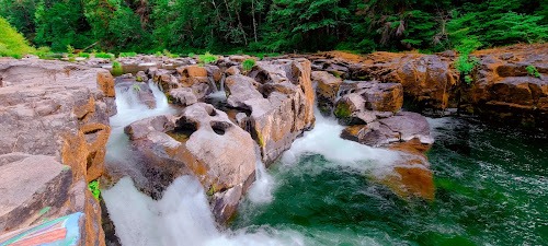
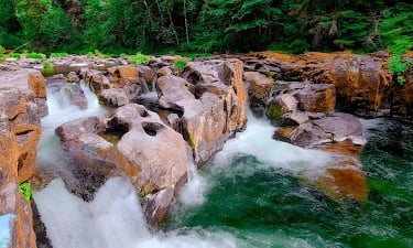
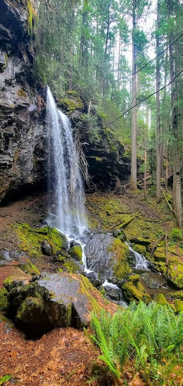
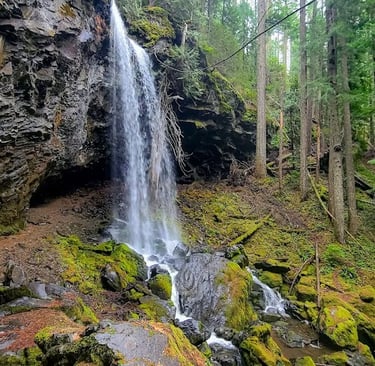
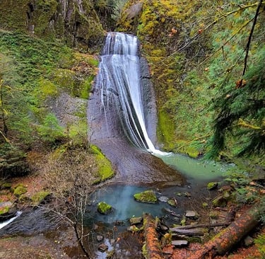
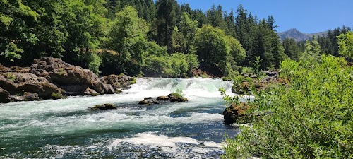
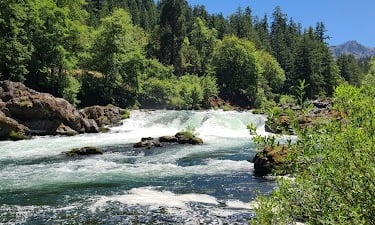
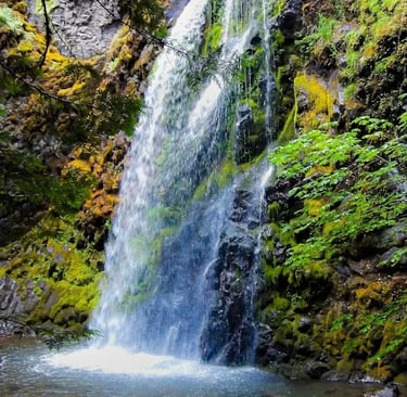
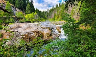
Location = Steamboat Falls. 39 mile marker on Hwy 138, OR. FYI: no fishing allowed.
After you park, it only takes a couple minutes to reach Steamboat Falls. The water flows gently over large stone slabs thru a small canyon before cascading down into a fairly deep emerald pool. See photo up top. You can see why Steamboat Falls is a popular spot for sun bathing on the flat rocks & jumping, and diving in for a refreshing swim.
If you visit Steamboat Falls from May thru July - watch for the trout as they jump up the rock ledge ladders to get 25 feet up and over the falls. We heard the area also has some good mountain biking trails. Send us a pic of you in your favorite waterfall location.
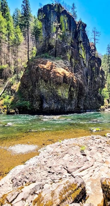
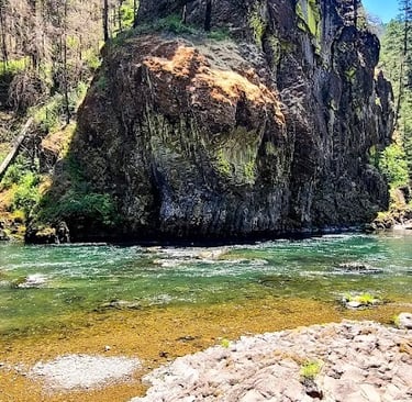
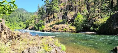
Horseshoe Bend Whitewater Rafting
Location = Horseshoe Bend. From Hwy 138 & Steamboat Creek Rd intersection, go about 8.5 miles, then right on NF-4750 and right on NF-001. The raft launch site and parking is just up the road on the left.
Horseshoe Bend is a great change of pace, and perfect if you're partial to the rush of adrenaline. If there's been good winter rains, Horseshoe Bend has some great whitewater rafting. I've been told the fishing is pretty nice as well. Best times to go whitewater rafting is during spring or early summer.
FYI: Call the U.S. Forest Service at Horseshoe Bend Campground to check on water levels prior to booking your whitewater rafting tour.
Psst - Don't forget Part 2: Waterfall Hwy & Crater Lake.
Steamboat Falls
Vacation Travel Tips
Average temps high/low = Summer 68/51 degrees F. Winter 53/40. Summer may get some rain. Winter rarely snows. It's usually windy, and adds a chill in winter.
There are a few places that require a “pass” or $5 cash.
Backpack essentials - water, bug spray, sunscreen, whistle, flashlight, cell phone, pocket knife, camera, and a light jacket for summer.
Winter Essentials - waterproof hiking boots, and warm clothing.
Hiking conditions - trails can be wet & slippery even in summer.
Vehicle safety – keep a spare blanket, boots, jacket, gloves, and snacks in the car. All season tires are sufficient even if it's icy a few days.
Wild animals - rarely seen on trails, but they're out there.
Trash - pack out what you pack in.
Rivers/lakes – river shoes are a must. Be mindful of currents & water temps. Heavy winter rains/snow means cold, deep & fast moving water. Most coastal cities are next to large rivers that flow into the Pacific Ocean.
Rattlesnakes - not usually found above 6,000 ft.
Wilderness areas – take a buddy & tell someone your travel plans.
Tourist season - Due to the small town coastal culture, tourist season brings heavy traffic, including motorhomes on single lane roads. Locals from inland areas also come for fishing, camping, and sand-dunes in the summer & on holidays, so parking may be limited.
Poison oak - Not on the coast, but is found 30-40 min. drive inland.
Snakes - mainly garter snakes on the coast.
Wilderness areas – take a buddy & tell someone your travel plans.

