
Antelope Canyon & Lake Powell - Flagstaff/Page, AZ
In Flagstaff - fun things to do at Fort Tuthill Park and hike Walnut Canyon to the cliff dwellings. In Page - tour Antelope Canyon's swirling red rock with a Navajo guide, stand above iconic Horseshoe Bend forged by the Colorado River, and explore Lake Powell's sandstone cliffs & hidden Rainbow Bridge.
Antelope Canyon & Lake Powell
Table of Contents
Location = Fort Tuthill Park. 2446 Fort Tuthill Loop, Flagstaff AZ. Free entry, special events & rentals have fees. Open 7 days/week, check holiday closures.
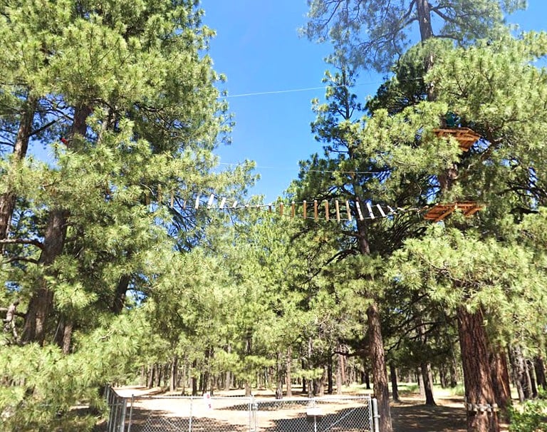
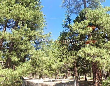
Fort Tuthill County Park has almost everything: archery, disc golf, bike park, hiking/biking trails, and fairgrounds. Go horseback riding at the arenas or take the cross country course on a horse. If you like the aerial adrenaline stuff - do the extreme adventure course.
More fun stuff: the World War I and II historic military area or catch a concert at the Amphitheater. If you're there in winter - don't miss their Snow Park and magical North Pole Experience.
There are several trails within the Fort Tuthill Park from 1.5 miles to the 5.2 mile loop, photo right. Or, go for it - take the 42 mile non-motorized loop around Flagstaff, accessed from the Park.
Fort Tuthill County Park
Location = Walnut Canyon Monument. 3 Walnut Canyon Rd, Flagstaff AZ. $15 to $25/vehicle pass required. Open 7 days/week, 9am-5pm, check holidays. Stop by the Visitor Center & Museum.
FYI: NO pets allowed in the Visitor Center or Island Trail. NO pets allowed in vehicles. Cell phone coverage is spotty. Weather can change rapidly: afternoon storms (July-September). Expect high winds & heavy snow (fall-spring).
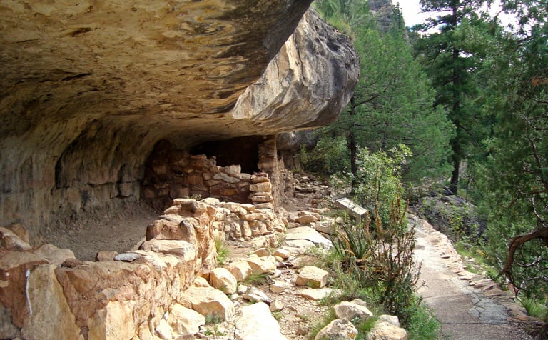
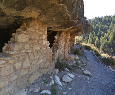
The Walnut Canyon Visitor's Center is at the top of the canyon at 6,690 feet. The canyon is reported to be 350-600 feet deep and it's here that the Sinagua Indians made their home in cliff dwellings around 1125 to 1250 AD.
Then, the Sinagua just disappeared - exact reasons are unknown. Sinagua is Spanish meaning "sin" (without) and "agua" (water). Since the waters of Walnut Creek created the canyon and was a water source, I'm not sure why that name was chosen.
Walnut Canyon: Cliff Dwellings
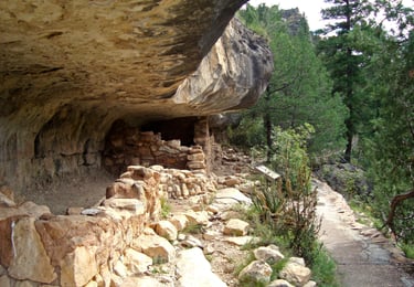
Rim Trail - the Rim Trail is .7 miles roundtrip, and leads you to the ruins of both types of original dwellings before they started building their permanent cliff dwellings. Walnut Canyon includes the original dwellings - the pueblo, built above ground and the pithouse, built below ground. The trail follows the rim past an area of Sinagua farm land, including a side trail that takes you to a lookout point across from the cliff dwellings.
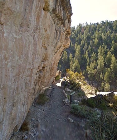
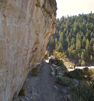
Island Trail - the Island Trail is 1 mile roundtrip and takes you alongside the ruins of 25 cliff dwellings - which is the Walnut Canyon Monument. It's a spectacular historical site, having the creek below for fresh water, the cliff overhang to protect them from the elements, and a strategic location to protect against invasion. Impressive to say the least, especially since they had to make a daily trek to the canyon floor to get water.
If you're fascinated with history like I am, Walnut Canyon is a must see. FYI: Everyone in average condition can make the hike down into the canyon and back up. If you're fairly inactive, just remember - there's no rush.

Walnut Canyon Monument
Location = no address to Horseshoe Bend, Page AZ. From the intersection of Hwy 89a and Hwy 89-N, drive 21 miles north, then left on Page Parkway to parking.
FYI: Horseshoe Bend parking fee = $5 to $10, open sunrise to sunset. NO drones allowed. Hiking & wheelchairs only. FYI: the National Park Service will advise of any "Alerts" for Glen Canyon Park. Always carry extra water.
Horseshoe Bend is 1.5 miles roundtrip on a flat trail. The bend was carved out by the Colorado River and is about 1,000 feet deep. The river used to flow into the Gulf of Mexico, but overuse has reduced water levels and no longer reaches the gulf.
Whoah....not a fan. Fear of heights won't let me stand on the edge of oblivion. Back up.... back up.....
Horseshoe Bend
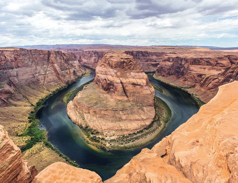
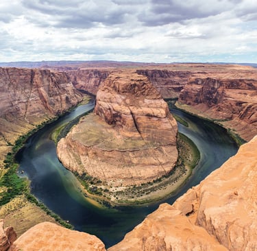
Horseshoe Bend is an incredible natural site, and is a recognized landmark. We heard from locals that you can actually get to the bottom of Horseshoe Bend if you take a raft or kayak from Lee's Ferry. My research revealed the Navajo Nation owns several properties around Arizona, including this trail & lookout. You'll notice that none of my photos will ever be taken from the intersection of solid ground and the abyss.
Location = Antelope Canyon. Hwy 98, Milepost 299, Page AZ takes you to Navajo Tours. Antelope Canyon is accessible only by guided tour. Prices $100 - $120 + fees/taxes per person, including infants, so maybe get a babysitter. No mono/tripods or selfie sticks. Check-in 30 minutes prior to the 1 hour tour of Upper Canyon. Total = 90 minutes with transport. Lower canyon tours are also available but there are 8 ladders to climb and fairly tight corridors.
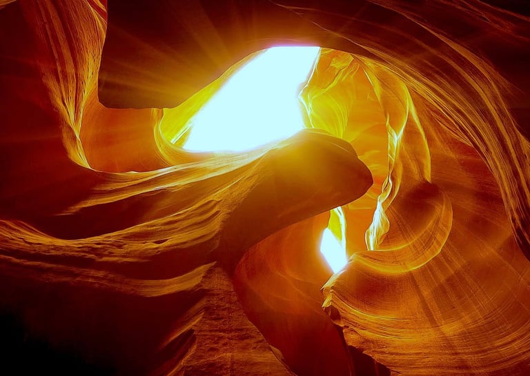
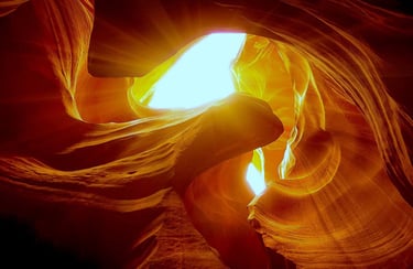
Antelope Canyon is located on Navajo land and considered a sacred monument which they named: "the place where water runs through rocks”. The Canyon is a place where they can connect to Mother Nature in a spiritual way. Your Navajo guide will provide interesting facts about the geology, Navajo history, and culture surrounding the canyon.
Inside, you'll see the beautiful & unique works of nature when water flowed thru this canyon creating the wave like patterns. It's truly stunning and a gift to treasure.
It also has a quiet stillness inside - except for the sun's movement that streams rays of light down thru the crevices & then fades to dark. It's easy to see why the Navajo consider Antelope Canyon sacred.
From the river bed at the base, the canyon walls rise 120 feet up, and depending on what season you visit in - you can ask Navajo Tours the best time to catch the light. This is what makes Antelope Canyon one of the most popular canyons in the world.
Antelope Canyon
Location = Carl Hayden Visitor Center. 1000 US Hwy 89, Page AZ - just south of Glen Canyon Dam & Lake Powell. You must buy a National Park Pass - $25/vehicle for 1 day, available at the Visitor Center & all entry points. Extra fees apply for access to Navajo lands.
FYI: Check for: Water "ALERT" Advisories. On occasion, there is harmful algae growth in the lake that can cause severe illness.
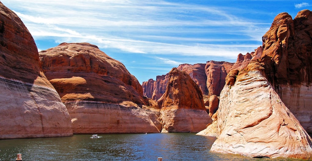
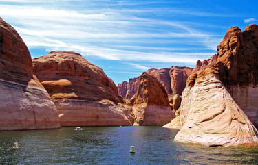
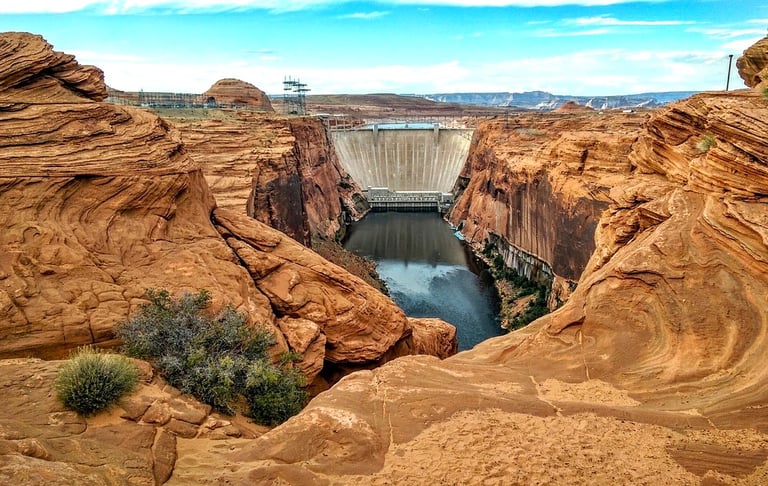
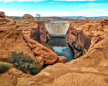
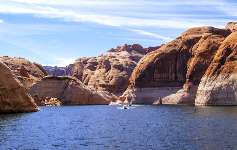
Lake Powell is one of the largest man-made lakes in the world, and a major resort area. It has 1,960 miles of shoreline - that's longer than the USA's west coast. Originally it was part of the Colorado River, however, the Glen Canyon Dam built in 1957 to 1963 created the lake. The Glen Canyon Dam is a 710 foot high concrete wall with a maximum width of 300 feet at it's base.
Much to explore - There's so much to explore on Lake Powell, like Rainbow Bridge Monument by boat. There's several beaches plus 96 major side canyons. Are you itching to get in the water? To answer your question - YES, you can swim in Lake Powell. The summer season brings the water temperature up to 78 degrees F. bathwater. See photo up top.
Rentals & Tours - Several Marina's at Lake Powell have rentals: kayak, speedboat, jetski, and pontoon boat. If you're looking to live on the water, try a houseboat - I've never been on a houseboat but friends say it's loads of fun. Personally I've owned jetski's and a boat before, and both are super fun options. A jetski provides a little more freedom squeezing between canyon walls & riding in shallow water, while a kayak brings a calmness to the activity.
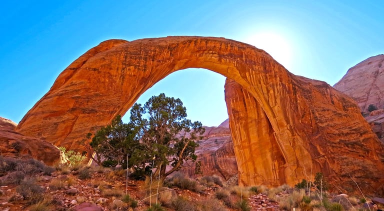
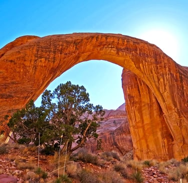

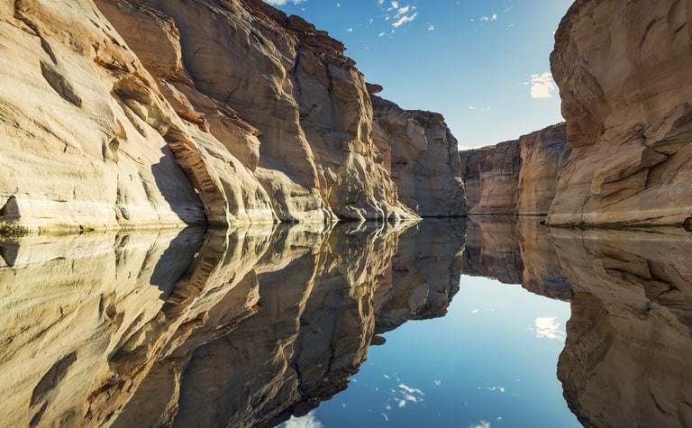
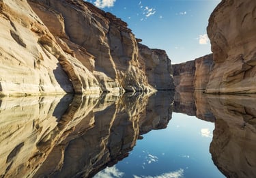
Rainbow Bridge Monument is accessed by boat - go to Buoy 49, Forbidding Canyon. Follow the floating sign to the right for 2 miles. Follow the next sign to the left thru a narrow canyon & proceed slowly. Buoys warn: DON'T make waves.
The trail to Rainbow Bridge is about 2 miles roundtrip. On the west side of Rainbow Bridge, are plaque monuments that pay tribute to the guides who led white explorers to the site.
It's really cool, and so is the route to get here - it almost has an Indiana Jones vibe.
Lake Powell
Rainbow Bridge Monument
Tidbits of History
Page, Arizona sits at 4,300 feet elevation and was developed to house the construction workers of the Glen Canyon Dam in 1957-1963. Page is known for several popular attractions, like Antelope Canyon, Horseshoe Bend, and Lake Powell.
Recreation, tourism and the National Park Service make up a majority of their industry. Well known movies were also filmed here: 2013 The Lone Ranger, 2017 The Greatest Showman, and 1967 Planet of the Apes.
More Fun Things to Do - Page
Best times to visit are March to mid-Jun and Sept to mid-Dec.
Colorado River - the only access point for 700 miles that you can drive to is Lee's Ferry. A historical site & launch for commercial rafts & personal kayaks. There is a small vehicle fee.
Carl Hayden Visitor Center - has Glen Canyon Dam exhibits & viewing platforms of the inside & the bridge.
Powell Museum - Major Powell was given credit as the first to lead people thru the Grand Canyon in 1869.
Kayak/Raft Tours - tours are available from 1/2 day trips up to a couple weeks.
National Parks - nearby Zion Park in Utah or the North or South Rim of the Grand Canyon.
Hiking & biking trails - Beehive Trail, Hanging Gardens Trail, the New Wave Trail, and the longer Rimview Trail.
Page, AZ
Travel Tips - Flagstaff/Page
Average temps high/low = Flagstaff at 7,000 feet elevation, summer 82/43 F. and winter 45/18 F. Page at 4,300 feet elevation, summer 94/70 F. Winter 50/30 F.
Expect snow: Flagstaff about 100 inches/year and Page about 4.5 inches.
Expect monsoons: In July-September, short periods of thunderstorms & heavy rains which causes flooding. Hikers & swimmers use caution.
Backpack essentials - EXTRA water, bug spray, sunscreen, whistle, flashlight, cell phone, pocket knife, and a light jacket.
Winter Essentials - thermal blanket, waterproof boots, warm clothing.
Hiking conditions - trails can be wet & slippery, or unstable due to sliding rocks & gravel and steep terrain.
Vehicle safety – Keep a spare blanket, boots, jacket, gloves, and snacks in the car. Winter roads can be icy & snow covered: all-weather tires should be OK.
Wild animals - black bears are becoming bolder in parks/campsite areas mostly due to food. Also: big horn sheep, elk, coyotes, bobcat, and javelina.
Trash - Pack out what you pack in.
Rivers/lakes – river shoes really help on the rocky bottom. Heavy winter rains mean deep, ice-cold & fast moving water in spring.
Poison oak & ivy - always know before you touch. The common Oak has 3 leaflets per stem but can have more. Ivy always has 3 leaflets.
Poisonous snakes - 2 types, the rattlesnake & coral snake. They generally prefer to avoid humans, usually biting only if threatened. There's also poisonous scorpions, spiders, centipedes & others.
Wilderness areas – take a buddy & tell someone your travel plans.


Health & Travel Vibes
USA Based. © 2023. All rights reserved.