
Death Valley/Palm Springs, California Travel - Desert Oasis & Aerial Tram
Explore 2 desert landscapes. Death Valley: visit Borax Museum, Badwater Basin's salt flats, Artist Palette's rocks & hike to Red Cathedral Mountain. Palm Springs: see Thousand Palms water oasis, ride Palm Springs Aerial Tram up San Jacinto Mountain, and hike Tahquitz Canyon on Indian ground.
FYI: Death Valley entry fee: $15-$30/vehicle or America the Beautiful Pass. Cell phone service is spotty. Open 365 days. Death Valley is the largest national park in the USA, except for 2 parks in Alaska. It covers 3.4 million acres. The terrain includes steep, rugged mountains and deep canyons, sand dunes, salt flats, badlands, natural springs, and historic cultural sites. Death Valley was not well known in the 1800's, except to the Shoshone Indians & a few prospectors looking for gold in the mountains.
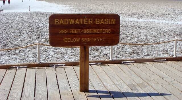
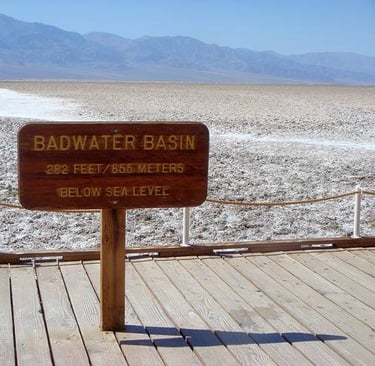
Badwater Basin
Location = no address to Badwater Basin. It's about 18 miles south of Furnace Creek on Badwater Rd. The wooden walkway and trail that leads you well into the salt flats is on the right. Badwater Basin is 282 feet below sea level making it the lowest, driest, and hottest place in North America and the 7th lowest elevation in the world. Be prepared for crowds since it's the most popular tourist attraction in Death Valley.
The salt flats cover an area almost 200 square miles. The salt you see is actually table table salt with a few other minerals mixed in. The area does get some rain so Badwater Basin collects a lot of rainwater runoff from the surrounding mountains, which contains salt & minerals. Occasionally there are flash floods, and a shallow lake forms over the Basin.
Plan on spending 4-7 days. See Travel Tips below for extreme heat info. Safety: hydrate prior to hiking in the heat. If you get a headache in the sun, you're already dehydrated. See Travel Tips below for summer temperature warnings.
Don't miss: Trees so Big You Can Drive Thru, CA
Death Valley, California


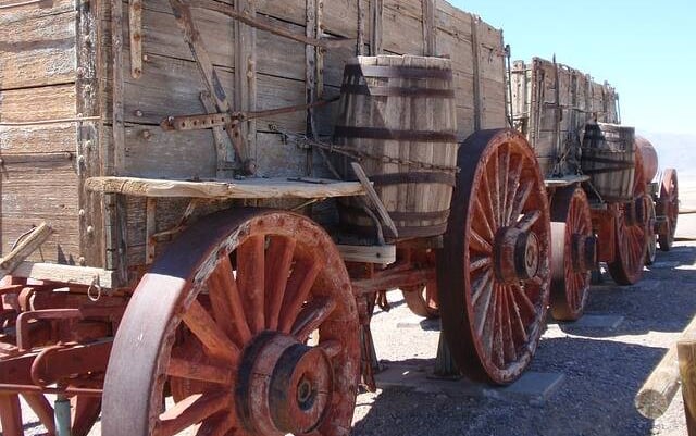
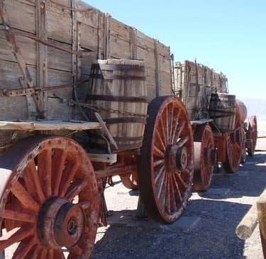
Location = No address to Borax Museum. On Greenland Blvd off CA-190, Furnace Creek CA.
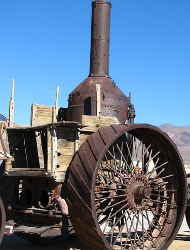
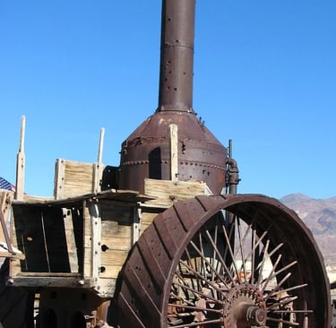
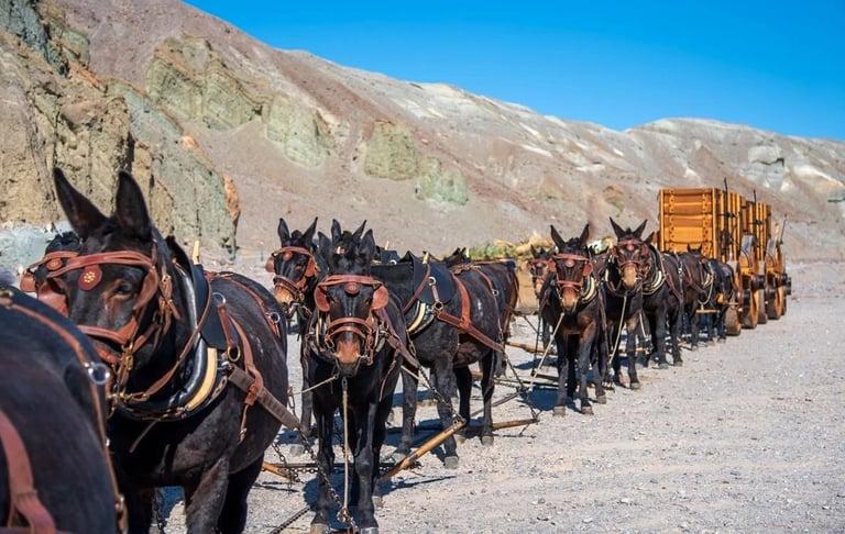
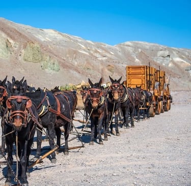
The Borax Museum is like Fred Flintstone meets Steam-Punk with train cars, wagons, mining equipment, and the 20 mule teams which transported the borax out of Death Valley. The Billie Mine underground is still in operation today. However, the Harmony Borax Works was the original borax mine that opened in 1883, only to close 5 years later. They became famous for their 20 Mule Teams, and the Borax Museum includes the wagons used by the 20 Mule Team.
The mules would haul borax & their own feed a distance of 17 miles per day - laboring thru the desert for 330 miles roundtrip. Borax is a white powdery substance used in so many products: from eye-wash to mold-retarding washes on fruits & leather, a preservative in makeup & food, and used in a deck of cards & paint, etc. The Borax Museum is worth the short visit to see how man & animal survived in the extreme conditions of Death Valley.
Borax - 20 Mule Team Canyon
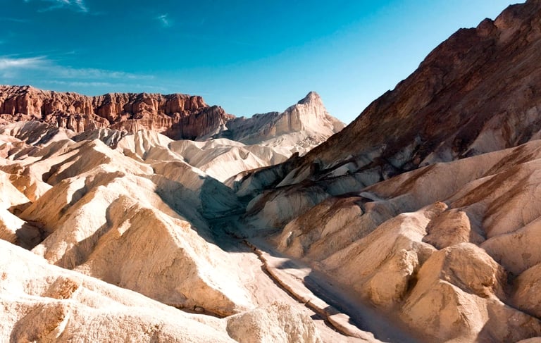
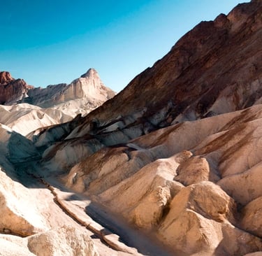
Location = No address to Borax 20 Mule Team Canyon. On 20 Mule Team Rd off CA-190. It's a one-way road that connects back to CA-190 further south. The 20 Mule Team Canyon is the original route - teams of 20 mules would pull a line of wagons filled with borax out of Death Valley and back, taking 19 1/2 days roundtrip.
Borax Museum
Location = No address to Artist Pallette. From the intersection of CA-190 & Badwater Rd, go south on Badwater Rd about 8.5 miles, then left on Artist Drive (which makes a scenic loop back to Badwater Rd), then left on Artist Palette. FYI: your vehicle must be less than 25 feet long due to road dips & curves.
At Artist Pallette, you'll see orange, red, yellow, and green colored rocks created from volcanic activity. The minerals & metals in the earth is what produces the colors. You'll also see swirling hills that were shaped by flowing water, the Black Mountains and white salt flats. Although it's fairly desolate, it still an interesting & beautiful landscape.
Photography lovers - you might want to catch the views of Artist Pallette at sunset. Probably sunrise as well - I'll be in bed at that hour, but you can tell me all about it. In my opinion - any hour before 6:30 am is really night-night time. Back to the narrative - Artist Pallette is another amazing display of what nature can do.


Artist Pallette
Location = No address to Red Cathedral Mountain trail. From CA-190 go south on Badwater Rd for 2 miles and you'll see the parking lot on the left and a brown sign: Golden Canyon. FYI: NO dogs allowed. Drink 4.25 cups water/hour while hiking in hot/dry climates. * Hack: hydrate 1-2 hours before hiking.
Red Cathedral Mountain is a popular hiking destination and located within the Golden Canyon area of Death Valley. It's 2.9 miles roundtrip with 750 elevation gain and no shade. Restrooms in the parking lot. Red Cathedral Mountain is an impressive red rock cliff that has eroded over time becoming more like pillars that are clumped together. Bottom right photo, in the background.
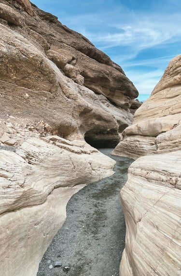
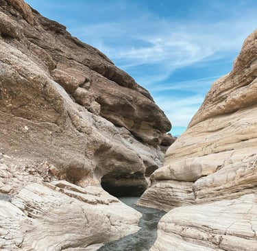
For the first mile, you'll be hiking uphill thru the Golden Canyon area. You'll go thru a corridor with jagged cliff's of pale yellow rock. In a couple spots you'll climb over boulders & then under a ledge. As you're crossing the Golden Canyon badlands - take a moment to look around to appreciate the unique beauty of the desert landscapes. You'll know when you've reached the end - the Red Cathedral Mountains are unmistakable against the golden peaks around it.


Red Cathedral Mountain
Death Valley
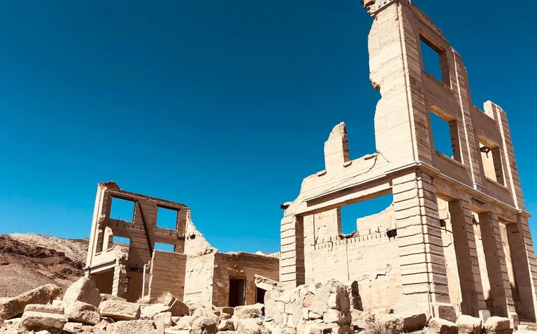
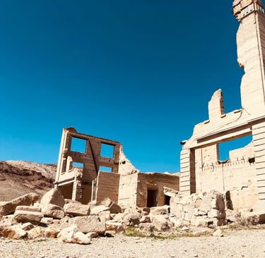
Rhyolite Ghost Town - In the early 1900's this town had over 10,000 residents. Everyone vanished within 10 years.
20 Mule Team - visit 20 Mule Team Canyon used by Harmony Borax Works. Photo courtesy: National Park Service.
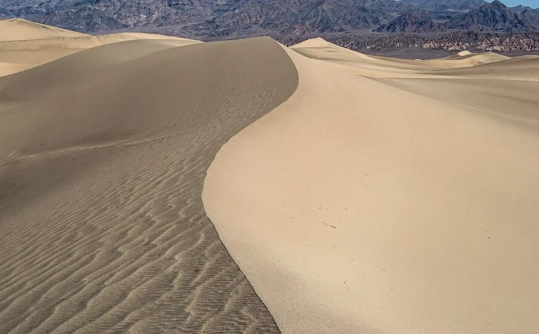
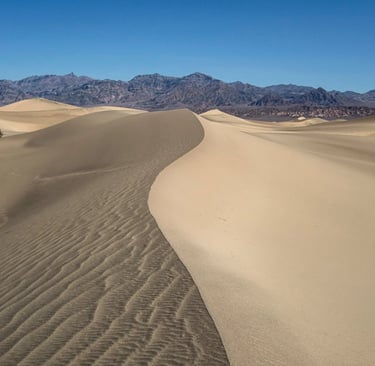
Mesquite Flat Sand Dunes - named after the Mesquite tree with a slender dark reddish-brown trunk. The bean pods that grow on the trees are used by the Indians to make flour.
Sand Sledding on the Dunes - use a sandboard and slide like the wind down the slopes. Or, try a boogey board if it has a plastic bottom. Add high-temp surfboard wax to make it super slick. Plus you get a nice leg workout hoofing it back up the hill.


More Fun Things to Do - Death Valley
Furnace Creek area - Horseback riding except in high heat, and a Golf Course.
Burned Wagons Point - About 1849, a group from the Midwest traveled thru Death Valley as a short cut to the gold mines in California. They weren't really prepared & suffered in the dry, hot desert with no water source. For food, they dried the meat of some of their oxen, burned their wagons, and took what was left to continue their difficult trek west. If you see Stovepipe Wells nearby - it was built years later as the only source of water in the dunes area.
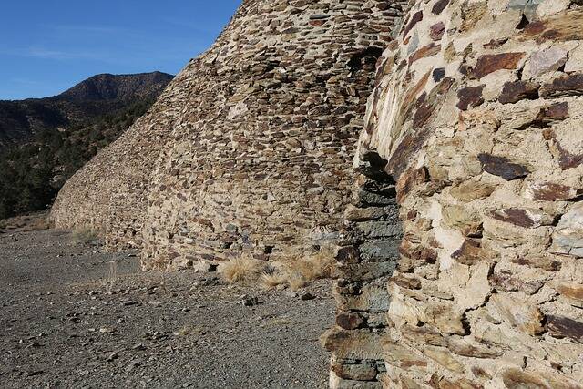
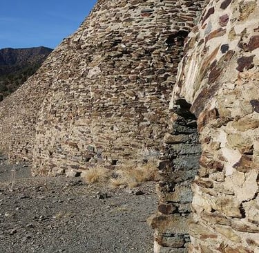
Wildrose Charcoal Kilns - Built in 1877, these 10 ovens in the shape of bee-hives were used to process silver & ore. They still smell like smoke today. Vehicles low to the ground will have trouble on the gravel road. Farabee Jeeps has tours.
View Points - Dante's View & Zabriskie Point are the most spectacular viewpoints, and the sunset hour will throw a golden blanket over the earth's surface.
Stargazing - In the desert's pitch-black night, the sky comes to life with a brilliant & breathtaking display of lights.


Location = Palm Springs Visitor's Center. 2901 North Palm Canyon Drive, Palm Springs CA.
Palm Springs encompasses 94 square miles, and 10% is owned by the Cohuilla Indian Tribe - perhaps the wealthiest tribe in California. As of 2020 the population was less than 45,000 however, the population triples during the spring & winter seasons due to the retirees & snowbirds. Snowbirds are people who move from their primary home right before the cold, snowy climate starts to their second home located in a warm climate. Around late spring, they move back.
Palm Springs became USA territory in 1848 after the Mexican-American War. In 1876, the USA established the Agua Caliente Reservation - meaning "hot water" for the Cohuilla who originally named it Se-Khi, meaning "boiling water". Yep, it's true the little amount of water that is there does get pretty hot so don't go thinking you can have a refreshing & cool dip on a scorching day! Read about Thousand Palms desert oasis below.
The Spanish explorers referred to the area as "La Palma de la Mano de Dios" meaning the palm of God's hand. To me that's kind of odd considering how hot it gets. Wouldn't it make more sense if it was called: de la Mano del diablo, the devil's hand?


Palm Springs, California
San Jacinto Mountain
San Jacinto's peak is 10,8374 feet, and the shortest trail is 11 miles roundtrip from the top of the Palm Springs Aerial Tram.
From the Tram - follow the sign to Round Valley then up to Wellman's Divide. At the junction, head up to the peak. In winter months you can also cross-country ski or snowshoe.
The challenging route is 17.1 mile roundtrip on Deer Springs Trail in Idyllwild CA. On my last trip, a 2-seater plane flew by at eye level. We waved to each other - how SUPER cool is that?
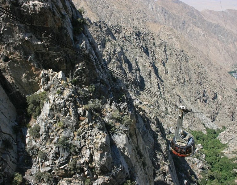
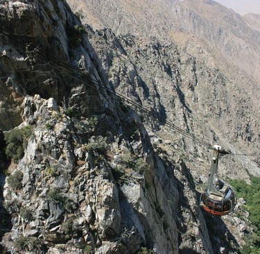
Location = Palm Spring Aerial Tram. 1 Tramway Rd, Palm Springs CA. FYI: the Mountain Station at the top of the Aerial Tram has dining, gift shop, lockers & restrooms. The hike is awesome to the top of San Jacinto Mountain.
The Palm Springs Aerial Tram is the largest rotating aerial tram in the world. Ticket lines may get long, so maybe purchase tickets online. Hiking up San Jacinto Mountain is one of my favorite things to do in Palm Springs. What's yours?
The Aerial Tram takes you from the desert floor up to 8,516 feet. The ride is a little scary for me inside the glass enclosure. My fear of heights kicks in - I mean it's off the charts crazy high. You're just dangling there, with like TONS of weight hanging off a cable wire.
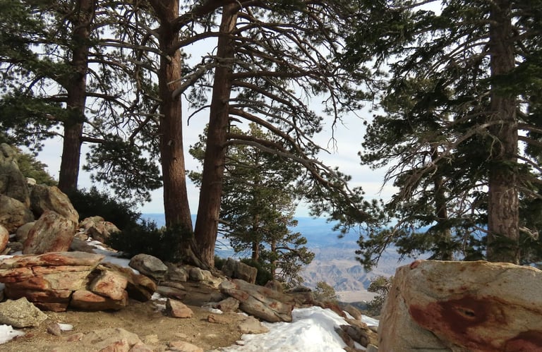
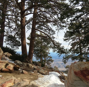
FYI: The air is thinner so it's harder to get oxygen. Breathing seems to get a little harder after 8,500 feet elevation when going uphill. Weather conditions on San Jacinto Mountain can change rapidly for the worst - so be prepared and carry warm clothes & emergency gear like whistle, flashlight, matches, thermal blanket under 1 pound, snacks, and extra water. Cell service is sometimes spotty. Wilderness permits are required.
Palm Springs Aerial Tram
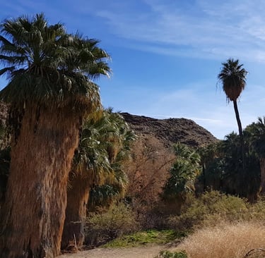
Location = Thousand Palms Oasis. 29200 Thousand Palms Canyon Rd, Thousand Palms CA. It's about 10 miles east of Palm Springs. Entry is free, however donations are appreciated. FYI: Some areas & trails are closed on different days or times. NO dogs or smoking allowed.
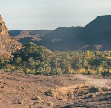
Thousands Palms Oasis is literally a desert oasis within the Coachella Preserve. Oasis means a fertile area with greenery or water in a dry area. There's 25 miles of trails in the Thousand Palms Oasis area that take you thru different desert landscapes. You'll get to explore a forest of palm trees and desert wetlands. Wait, WHAT?
It's hard to imagine "wetlands" in a desert? That's like an oxymoron. Thousand Palms Oasis sits on top of the San Andreas Fault Line, which causes water to seep up from deep underground forming pools & wetlands.
There's actually several ponds within Thousand Palms Oasis, and I was pleasantly surprised to see how big the desert oasis pool really is. The waters are so calm you can see the green palm trees mirrored in the water - blurring reality with reflection. Also, don't miss the wooden bridge thru a tunnel of palm fronds.

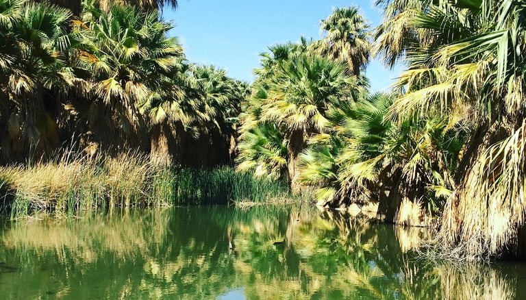
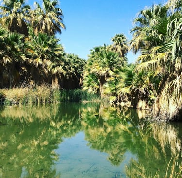
Thousand Palms Oasis
Location = Tahquitz Canyon Visitor Center. 500 W. Mesquite Ave, Palm Springs CA. FYI: Buy your $15 day hike tickets at the Visitor Center. They require you to have at least 32 ounces of water. If not, you can buy water there. NO dogs/animals allowed. There are some steep steps (up to 15 inches) to climb.
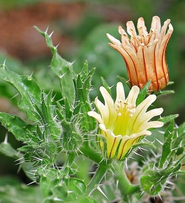
The scenery is really beautiful on the Agua Caliente (meaning hot water) Cohuilla Indian reservation. To get a glimpse into Native American history, visit Tahquitz Canyon. The Tahquitz Canyon trail is 2 miles roundtrip, with a very pleasant surprise - a pretty awesome 60 foot waterfall considering it's in a desert. It's prettier in early spring if there was enough rain during the winter. You'll also find some Indian rock art and various plant & animal life.
The Visitor's Center carries artifacts & souvenirs. I chose this trail because of the waterfall - you could pretty much say I'm a waterfall chaser. And yes - you can swim in the pool at the base of Tahquitz Falls....YIPPEE. The trails at Indian Canyon are also popular with flatter terrain and many prefer these instead.
More Fun Things to Do - Palm Springs
The area is overloaded with golf courses & country clubs.
Palm Springs Art Museum & Air Museum.
Living Desert Zoo & Gardens - It's a laugh and a 1/2 to feed the giraffe's.
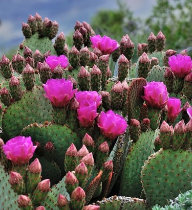
Moorten Botanical Gardens - cactus/native plants & a Villa called Cactus Castle.
There's multiple casinos if you're into gambling.
Hot air balloons, rock climbing, horseback riding, and more.
Find Marilyn Monroe and take a photo.


Tahquitz Canyon
Vacation Travel Tips
Average temps high/low = Summer 64/50 degrees F. Winter 55/42.
Backpack essentials - water, bug spray, sunscreen, whistle, flashlight, cell phone, pocket knife, and a light jacket.
Winter Essentials - waterproof hiking boots, and warm clothing.
Hiking conditions - trails can be wet & slippery from foggy conditions.
Vehicle safety – keep spare blanket, boots, jacket, gloves, snacks in the car.
Wild animals - elk, deer, bobcats, raccoon, and fox are commonly seen. Mountain lions, black bears, coyotes also inhabit the area.
Safety Tips: learn safety tips in case you encounter a black bear, mountain lion, or elk especially in rutting season Aug-Oct.
Trash - Pack out what you pack in.
Rivers/lakes – river shoes are helpful due to rocky river-beds.
Poison oak - always know before you touch. If it's growing up like a vine with reddish color in stem/leaves, it's probably poison oak. On the ground it has 3 leaflets.
Rattle Snakes - they do live in CA coastal areas, however they prefer to avoid humans, and only bite as a last option to avoid harm.
Wilderness areas – take a buddy & tell someone your travel plans.
Health & Travel Vibes
USA Based. © 2022. All rights reserved.