
Smoky Mountains, N. Carolina Travel - Waterfalls & Kuwohi Peak
Explore small towns, the Great Smoky Mountains within the Appalachians, and whitewater rivers & waterfalls like Nantahala Cascades & Tom Branch Falls. Don't miss Fields of the Wood, Oconaluftee Mountain Farm Museum, and Kuwohi (Clingmans Dome) & Newfound Gap.
To properly explore the best places in the Great Smoky Mountains - plan on spending 6-12 days depending on how much hiking, whitewater rafting, or horseback riding you do.
Want more? Best Paddle & Splash Whitewater in TN
About the Smokies
The Great Smoky Mountains National Park is 522,419 acres and located along the border of Tennessee and N. Carolina. To give you a size comparison: the 7 largest national parks in Alaska range from 1.7 to 13.2 million acres. That's beyond huge and all in one state. See Alaska's Mount Denali Park with 6.1 million acres. In the lower 48 states, California has the largest at 3.4 million acres at Death Valley Park.
However, what most people don't know is the Great Smoky Mountains - known as the Smokies, are part of the Blue Ridge Mountains - which are both within the Appalachian Mountains. The Appalachian Mountains cover 39.4 million acres and include 6 national parks spreading across 13, 14, or 15 states depending on who you ask.
All you hikers, whitewater paddlers, and outdoor lovers: THIS IS IT. Within the Smokies, there's 3 national forests and each one has whitewater rivers, horseback riding, hiking and mountain biking.... and that's just for starters.
Cherokee National Forest - 700 miles of trails.
Nantahala National Forest - 600 miles of trails.
Pisgah National Forest - hundreds of miles of trails.
One thing's for sure - I need to come back to explore more of these friendly mountain towns, majestic mountains, scenic byways, forests, whitewater rivers, and waterfalls.
Great Smoky Mountains, N. Carolina
Introduction Teaser Trip
This was a quick 2 day trip and kept us hopping from one place to the next. My friend had an old injury, so I chose shorter hiking trails. Starting from Cleveland TN - go east on Hwy 74. As you near Ocoee TN, you'll enter the Blue Ridge Mountains and Cherokee Forest.
Next up - a side trip down NC-294 by Murphy, NC in the Appalachian Mountains and Nantahala Forest, then back to Hwy 74. Then take Hwy 19 east to Bryson City and on to Cherokee which are both in the Great Smokies.
Finally, take Hwy 441 north to the last 2 stops on the NC and TN border. You don't want to miss Kuwohi, formerly Clingman's Dome, and Newfound Gap high in the Smokies. More trips to come.
Location = Fields of the Wood. 10000 NC-294, Murphy NC. Parking & entry to Fields of the Wood is free, however the Church of God would appreciate donations. Peak season is open April - November from 7 am to 7 pm. Off season is typically December - March from 8 am to 5 pm. Open hours depend on weather. Past their parking lot is a nice gift shop and Burger Mountain Cafe.
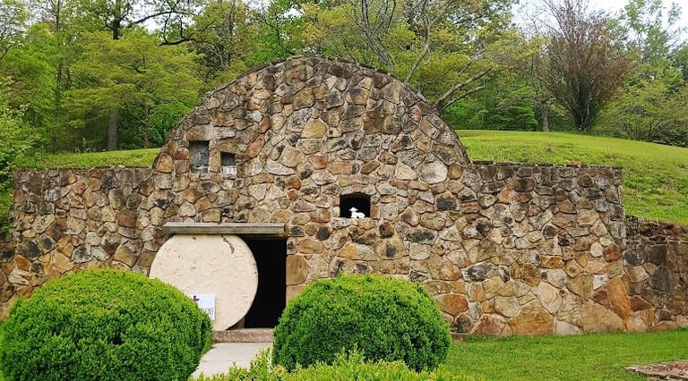
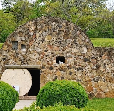
In June 1903, Ambrose Jessop Tomlinson used to pray on these mountains. Finally, in 1941 his vision began to take shape as he began construction of the Ten Commandments. They are the largest Ten Commandment display in the world and includes 358 steps to the top. He dedicated this biblical themed park the Fields of the Wood.
Fields of the Wood
Opposite the Ten Commandments hillside is another hill called Prayer Mountain, and it has 321 steps. Placed along the stairway to the top are 29 biblical monuments constructed of marble & stone and engraved with bible verses.
Prayer Mountain is nestled in the woods - it's a peaceful climb as you read verses and fill your spirit. Field of the Woods has several other biblical displays including the open Tomb, and Golgotha where Jesus was crucified.
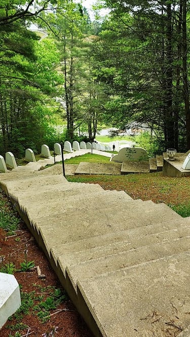
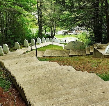
Fields of the Woods also provides all you travelers the chance to shake off the car seat booty cobwebs and stretch your legs. Read this first especially if you're going to climb up all 679 steps back-to-back. First, climb up to get your muscles warm, then - I recommend you give your calves a slow and proper stretch before climbing down.
Most people's calves are not used to this intense elongation every time you step down, so your calves are gonna start complaining - like later that day, and the next. Dumb move on my part because I didn't stretch. The next day I told myself to just keep moving because I still had to climb Kuwohi (Clingman's Dome).
After that little workout, it's time for lunch. We stopped in Murphy, NC and splurged on a burger. Sadly, it really upset my stomach. I can't handle the nasty vegetable/canola oils so Main Street USA isn't a restaurant I'd recommend. I was more eager to get to our next destination - gorgeousness coming up.
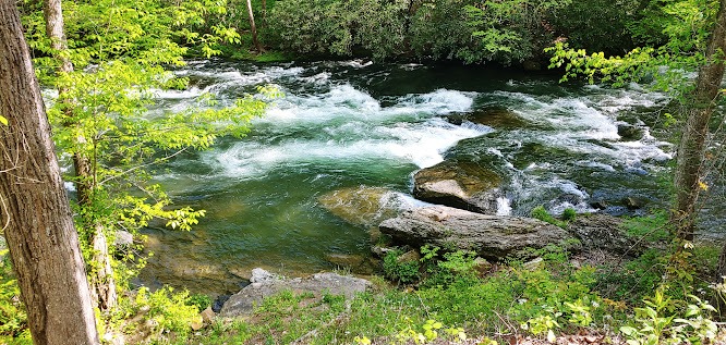
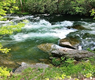
Location = Nantahala Cascades & Kayak Put In. No address, Wayah Rd (State Rd 1310), Topton NC. East of Topton, look for Wayah Rd on the right. From that intersection, it's about 3.9 miles to the the Nantahala Cascades. Along side the guardrail you'll see a tan colored fence on the right. After that is parking along the road.
There's no hiking to Nantahala Cascades - it's like right there. Well... I did walk the 50 feet or so out onto the large boulders leading out to the middle of the river, you know. I like to check the views from all angles. It's a gorgeous waterfall, even though it's more horizontal than vertical. The Cherokee name Nantahala means "land of the noon day sun".
The Nantahala River has plenty of whitewater so it's popular with the kayakers. After seeing these Cascades, I thought it might get the top rating in my book.... until I saw Tom Branch Falls the next day which won best overall for AMAZING. Keep reading, it's coming up.
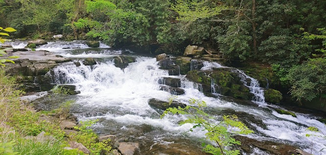
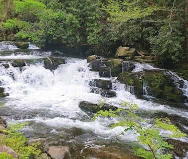
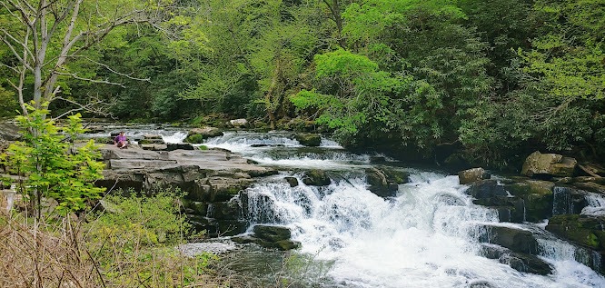
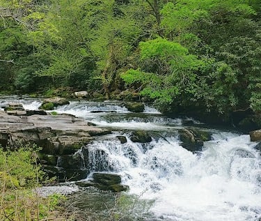
Nantahala Cascades
Location = Rufus Morgan Trail Access Rd. 5550 Wayah Rd, Franklin NC. From Nantahala Cascades Waterfall, continue to 5500 Wayah Rd. This is the Rufus Morgan access road to the trailhead on the right, and it's un-named. Drive 2 miles to the trailhead on the right. The hike to the falls is 1 mile roundtrip.
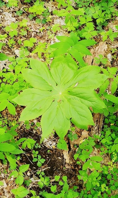
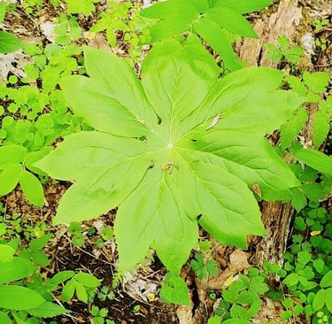
Rufus Morgan Waterfall trail begins in the forest wilderness and leads you uphill on a moderately easy trail. If you're there during spring, there's lots of wild flowers & interesting plants I've not seen before. As you near the waterfall, you'll see the tiniest foot bridge and some rocks you'll need to hop across to continue around the corner for better viewing options.
At the base of Rufus Morgan Falls, you can just barely make out the upper section of the falls thru the trees. Photo left - see the upper falls just slightly left of center above the lower falls.
From here, the trail is supposed to continue uphill to make a loop back down. With all the downed trees and new vegetation growth, I didn't see anything that we could even attempt to walk.
Back at the parking area, I investigated a bit and found a wide trail about 1/2 block down on the left, from the trail we took up.
This is likely where you'd finish if you can find the continuation of the trail to make the loop back down. Perhaps a machete might help!
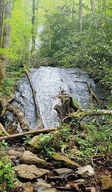
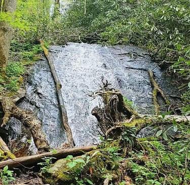
Rufus Morgan Waterfall
Exploring as we Go
From Rufus Morgan Waterfall we headed back to Hwy 74 and turned right, and soon made an unexpected stop at Patton's Run Overlook. In 1776, William Bartram from Philadelphia met Chief Atakullakulla and his band of Cherokee in the area. What a time to be out exploring!
At the opposite end of the parking lot there's stairs and a trail that lead you down to the Nantahala River. It's a nice scenic spot for a few more photos. You might even get lucky and see some kayakers paddling by.
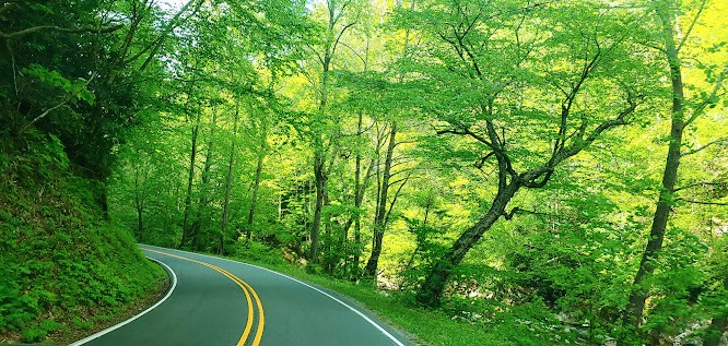
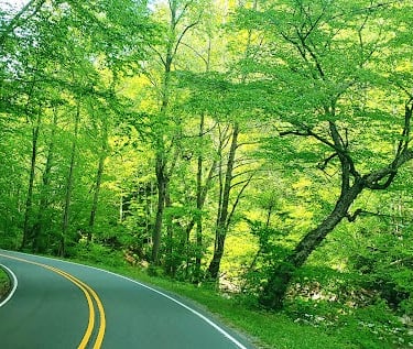
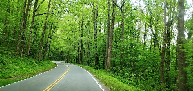
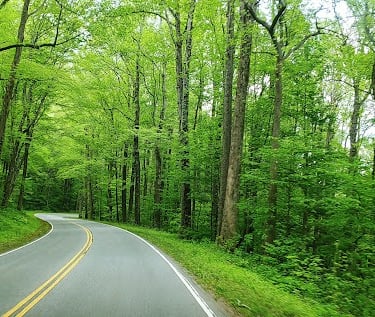
There's so many incredible views along this mountain highway 74, that I got pretty good at snapping shots thru the front & side windows. All 3 of these photos in this section were taken from a moving vehicle.
Small Mountain Towns & Highways
On to Bryson City. It's an adorable town where we had rented a cabin in the woods with horseback riding nearby if anyone's interested. I HIGHLY recommend splurging a little bit and opt for a cabin in the woods. What better way to experience the Smokies.... WAY better than a typical hotel stay, even the upscale ones.
We had a full kitchen to prepare dinner, an outdoor hot tub and a firepit. Not wanting to waste the hot tub, I gave my calves a good soak and got the muscles relaxed. Gotta say, that felt awesome. The mountain air was fresh, the stars were twinkling, and it was the perfect temperature.... nothing like nature to release the stress and slip into mello-mode.
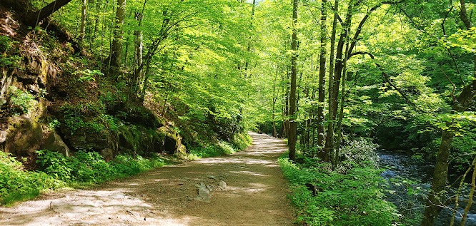
The next morning after breakfast, we headed northeast of downtown Bryson City and into the forest again. When I do my research for trip plans, I mostly gather data with very few photos so I leave some element of surprise. Time to head off to Deep Creek Trail to see 2 waterfalls Tom Branch Falls & Indian Creek Falls.
Tom Branch & Indian Creek Waterfalls
Location = Deep Creek Trail. Go past 1840 W. Deep Creek Rd, Bryson City NC and keep following that road to the end. The parking lot is on the left just before the dead end. At the end, you'll see a trail next to Deep Creek. Take Deep Creek Trail to see both Tom Branch & Indian Creek Waterfalls. It's an easy 1.6 mile roundtrip hike.
Tom Branch Falls
Starting on Deep Creek Trail, Tom Branch Falls is about 1/4 mile in and across the creek. The water cascades down over uneven rock ledges and the creek is crystal clear. Although this waterfall isn't massive in size - it's the falls and surrounding area that make it unique & positively enchanting.
The whole scene at Tom Branch Falls reminds me of the Disney movie Jungle Book. I glanced around at the thick overhanging branches half expecting the black panther, Bagheera to pounce into action at any moment.
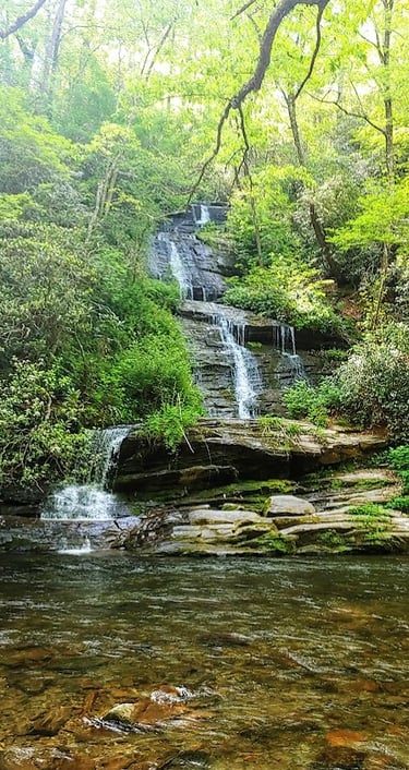
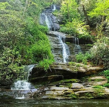
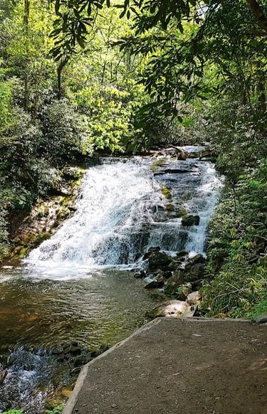
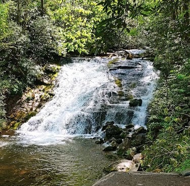
You may also notice how tranquil this gorgeous area is in the middle of this forest in the Smoky Mountains. And the creek - it keeps calling me to get in.
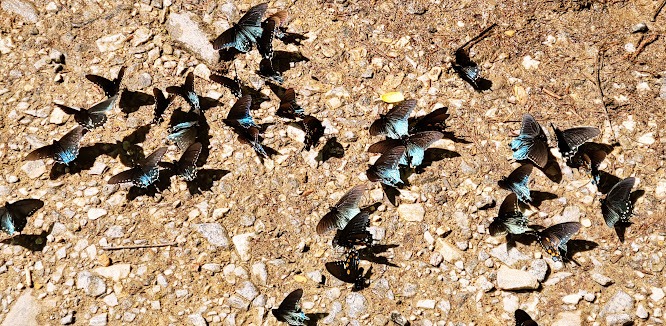
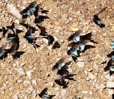
Past Tom Branch Falls a short distance, I stumble upon another treasure which I'm greatful for finding on all my adventures - click photo to enlarge.
There's at least 100 Eastern Swallowtail butterflies with almost iridescent blue tails which really stood out in the sunlight.
Butterflies need minerals, so they're feeding on the moist ground from a tiny waterfall trickle. They were so intent, they hardly noticed me standing almost directly above them.
Indian Creek Falls
From Tom Branch Falls, continue down Deep Creek Trail and stop to admire the scenery. After a bit, you'll cross a footbridge over the creek. At about .7 mile into your hike, make a right onto Indian Creek Trail.
From there t's a short .1 mile to Indian Creek Falls on the left. At the bottom of the short staircase, there's a concrete viewing platform. Personally, I think the big slab of concrete totally detracts from the beauty. If I had my river shoes with me I would have waded in to get a better photo.
Indian Creek Falls is still worth seeing, but doesn't hold a candle to the whole vision surrounding Tom Branch Falls. Next up - time to make our way to Cherokee NC and grab lunch.
All Fried Up is a nice family restaurant - they're quick, the food was great and not everything's fried. I had the blackened fish which was tender & tasty. I only eat fried food maybe 1-2 times a year - but I thoroughly enjoyed every bite of fried okra. I would totally eat here again.
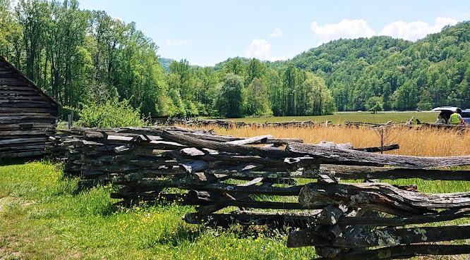
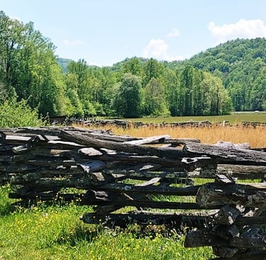
Oconaluftee - Mountain Farm Museum
Location = Oconaluftee Visitor Center & Mountain Farm Museum. 1194 Newfound Gap Rd, Cherokee NC. $5 parking fee, includes the Visitor Center and Mountain Farm Museum. It's open all year from sunrise to sunset. You can walk the area on your own or check with Oconaluftee Visitor Center for info on their audio tours.
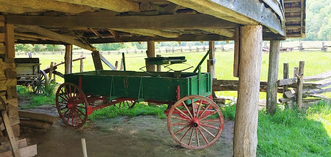
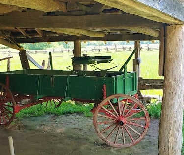
The Oconaluftee River runs along the Mountain Farm Museum, and offers an easy 3 mile roundtrip trail if you have the time. The museum is a collection of historic log buildings relocated to this property to preserve the way of life during the late 1800's. The John Davis farmhouse was originally located over in the Indian Creek area of Bryson City which we just left.
My research shows there are 2 large herds of Elk in the area, one of which frequents the fields by the Visitor Center. It would have been super cool, but bummer.... they were off grazing somewhere else that day.
I don't know if any of you have seen these historic fences before? The overall shape is like "VVVVVV". Normally you'd have a vertical support post along a straight fence line, but all these logs are horizontal. I'm guessing the "V" pattern was the support for the structure. Imagine all the labor - just living was a full time job.
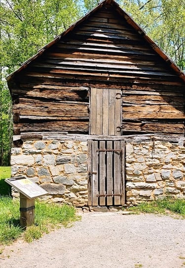
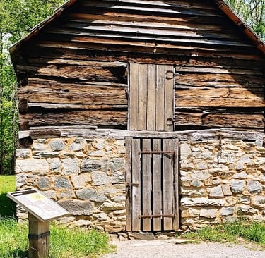
Some of the buildings include a blacksmith shop, a meat house, an apple house, and spring house. Spring houses were usually one room built over natural springs - a source of water and cooling system to keep food cool. It also served to keep the water clean and the animals out.
The apple house is pictured right. Mountain temperatures make it great for growing apples. Summer apples were stored in the 2nd story made of logs, and needing short storage times. The thick stone on the 1st floor would keep the winter apples cool & fresh for a much longer time period.
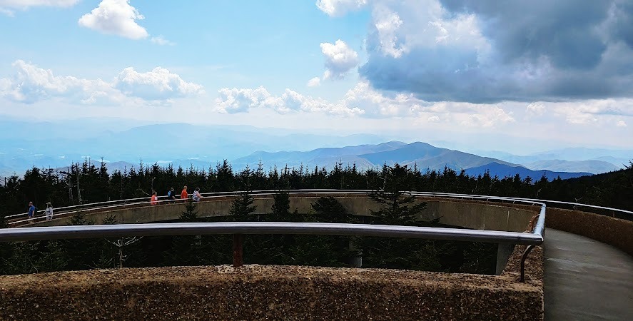
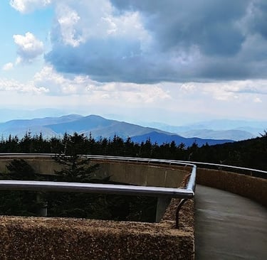
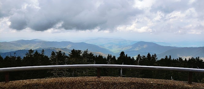
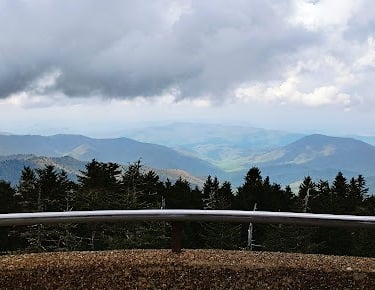
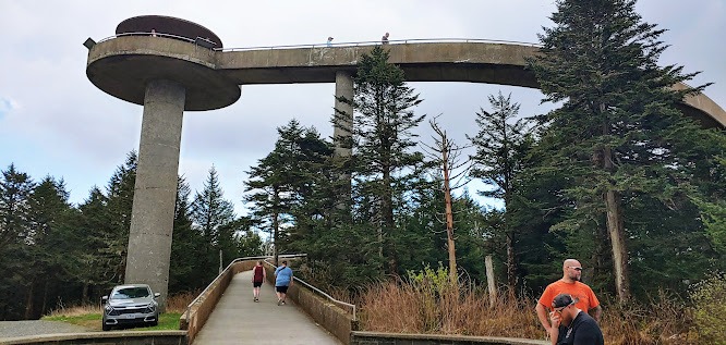
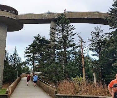
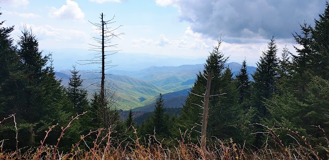
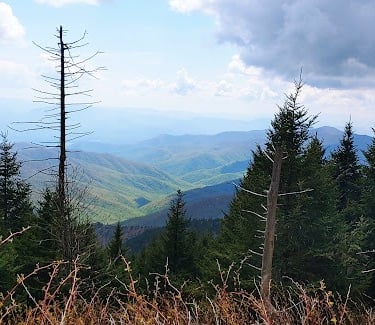
Location = Kuwohi parking lot & Visitor Center. From Hwy 441, a.k.a. Newfound Gap Rd drive 7 miles on Clingman's Dome Rd to the end. Parking is $5/day. Clingman's Dome Rd is open April 1st to November 30, depending on weather conditions. During summer's heavy tourist season, you might want to purchase your parking pass online before you go.
In 1859, Kuwohi mountain was renamed "Clingman's Dome" after Thomas Clingman, who had been expelled from the USA Senate. It was originally named Kuwohi by the Cherokee, and is still a sacred place for them. In September of 2024, the name Kuwohi was finally restored. See photo up top.
Kuwohi straddles both TN and NC, and it's the highest point in the Great Smoky Mountains at 6,643 feet elevation. After climbing the 679 stairs at Fields of the Wood yesterday, I found myself climbing the 1/2 mile steep path to the top of the mountain and then up the spiral walkway to the viewing platform. Imagine my surprise when I saw the vehicle at the top! Must be an access road that's less steep.
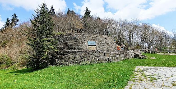
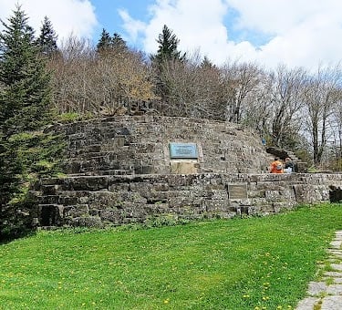
Location = Newfound Gap parking lot. From Cherokee, NC it's 19 miles north on Hwy 441. From Cherokee, you'll pass several viewpoints on the left, Kuwohi Rd on the left, and shortly after you'll see the large parking lot on the right for Newfound Gap. Parking tag is $5/day.
Interesting tidbit: Newfound Gap is 5,046 feet elevation which is significantly lower than Kuwohi at 6,643 feet. The Appalachian trail also goes thru Newfound Gap just as it does at the top of Kuwohi. Newfound Gap Rd was originally discovered by Arnold Guyot in 1872, and the road opened in the 1930's.
Prior to that, Indian Gap Rd was the only pass - it was higher in elevation and a steep, treacherous route used by pedestrians, Indians, farmers & livestock, and soldiers. At some point it was widened to 5 feet. Gosh, what was it before it was widened?


Kuwohi Mountain
Newfound Gap
I keep my legs pretty strong so they weren't complaining. However, your heart rate's gonna be up there the entire climb. I stopped for 1 minute about every 5-6 minutes. I mean.... where's the "interval" in high intensity interval training? LOL.
My friend with her old injury had a sore left knee & foot, so she stayed in the car. She insisted I go, so I tried to hoof it up a little faster. Murphy's Law I guess - it didn't level out until you get to the top. The sign to the Appalachian Trail is also at the top of this beasty hill.
The Appalachian Trail is 2,175 miles long that starts in Maine and goes thru the Appalachian Mountains ending in Georgia. Remember the Smokies & Blue Ridge are part of the Appalachians.
The Appalachian Trail is what I call EXTREME hiking. A friend of mine that lives in Tennessee wanted to do it with her horse but couldn't find anyone to go with her so her Dad said "no way". Anybody out there ever walk part of it? Anybody planning on going? I'd love to do a feature blog about you and your experiences on the Appalachian Trail. Who knows, you could get a movie deal and become famous!
Hwy 441 just north of Cherokee, NC is also called Newfound Gap Rd and goes all the way to Gatlinburg, TN. The "gap" refers to a mountain pass or route, and Newfound Gap is the lowest route you're able to drive thru these towering mountain peaks.
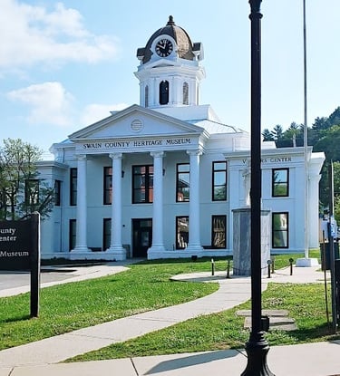
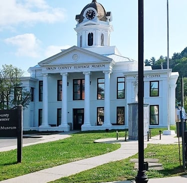
The Great Smoky National Park was dedicated at this spot in 1940 by President Franklin D. Roosevelt. The huge stone structure above left, has 2 tiers which literally straddles the border of North Carolina and Tennessee. The stone memorial was built to honor John Rockefeller Jr's donation of $5 million to help establish this National Park.
More Fun Things to Do
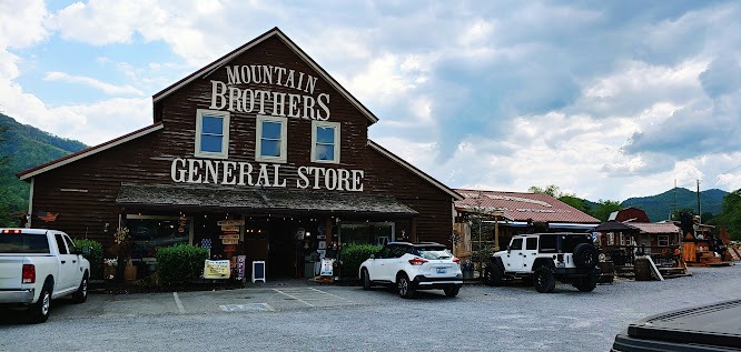
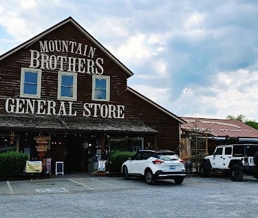
As we drove home not wanting to leave this gorgeous mountain scenery, we stopped at Mountain Brothers General Store in Sevierville, TN. There's a few separate buildings that sell coffee, ice cream & other goodies, and a lean-to where a man is carving intricately designed wood statues.
The Mountain Brothers General Store is pretty fabulous by itself. I'm not a huge fan of coffee, but I enjoy a nice cup every so often, so I walked out with a caramel flavor bean. Pick your favorite gourmet flavor and grind them up. You won't find these special items in your regular grocery store, and almost everything is locally grown & produced. It's like Trader Joe's but country style.
HOPE YA' ALL HAD FUN. Seriously, we "Can't Wait to Get on the Road Again" and explore more of the Great Smoky Mountains on the Tennessee side including Gatlinburg. * WIN A PRIZE - Be the first to email me the name of the music artist that sang that song.
Vacation Travel Tips
Average temps high/low = Average in Wilmington: Summer 89/74 degrees F. Winter 56/38 degrees F. Average in Great Smoky Mountains: Summer 79/56. Winter 43/20. Snow is expected in mountain regions.
Backpack essentials - water, bug spray, sunscreen, whistle, flashlight, cell phone, pocket knife, and a light jacket.
Winter Essentials - thermal blanket, waterproof boots, warm clothing.
Hiking conditions - trails can be wet & slippery after summer rains. Prepare for snow in higher elevations.
Vehicle safety – Keep a spare blanket, boots, jacket, gloves, and snacks in the car. Winter roads can be icy & snow covered - use “winter” tires. If you only have "all season" tires, take snow chains.
Wild animals - black bears are becoming bolder in parks/campsite areas mostly due to food. Coyotes, red wolf, cougar, bobcat, and elk are also present.
Trash - Pack out what you pack in.
Rivers/lakes – river shoes really help on the rocky bottom. Heavy winter rains mean deep, ice-cold & fast moving water in spring.
Poison oak & ivy - always know before you touch. The common Oak has 3 leaflets per stem but can have more. Ivy always has 3 leaflets.
Poisonous snakes - 6 types, found on land, water, and trees. They generally prefer to avoid humans, usually biting only if threatened. However, these are aggressive: water moccasin (cottonmouth), pigmy rattlesnake & eastern diamondback rattlesnake.
Wilderness areas – take a buddy & tell someone your travel plans.
Health & Travel Vibes
USA Based. © 2022. All rights reserved.