


Idaho/Washington Travel - Mountain Pass Hardships & Wilderness Waterfalls
Experience the untamed wilderness of Washington. Visit Franklin Falls and the first Wagon Road high in the Cascade Mountains at Snoqualmie Pass. See the stunning river scenery at Moulton Falls in Yacolt & Pothole Falls in Camas. Last stop is your choice - fun in Vancouver, WA or Portland, OR.
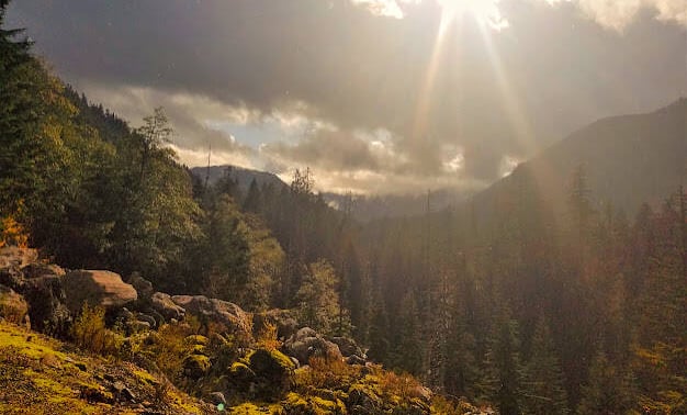
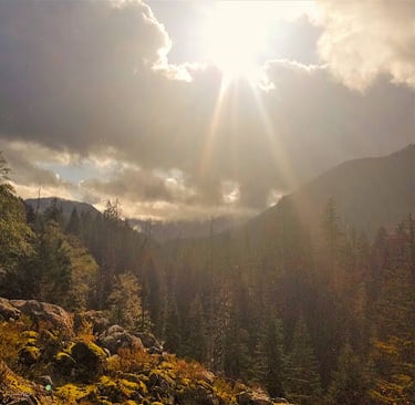
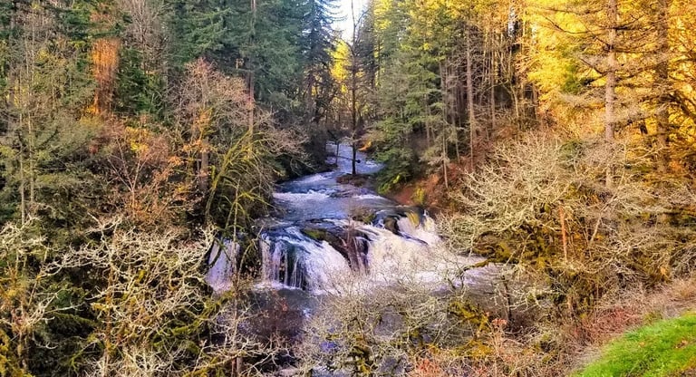
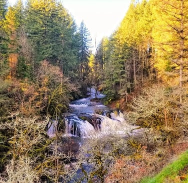
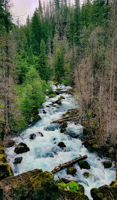
Franklin Falls
Location = no address to Franklin Falls. Off the Snoqualmie Pass in the Cascade Mountains, Washington. FYI: Hwy 90 NW lanes & SE lanes are separated here. River shoes around the falls & rock bed are super helpful if you plan on wading.
Directions to Franklin Falls - it's a little tricky, so pull up google maps. From Hwy 90-NW, take exit 47, then the 1st right. At the "T" intersection go right on NF-9034 and under the Hwy. Take the 1st left on NF-5800 aka Denny Creek Rd for about 2.5 miles, then left on FS-5830. The trailhead is on the right, just past the restrooms.
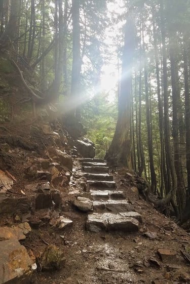
The Franklin Falls trail is 2 miles roundtrip & fairly flat, and the falls are a beautiful sight at 135 feet tall. Along the trail, look for glimpses of sparkling pools & cascading waters of the Snoqualmie River on your left.
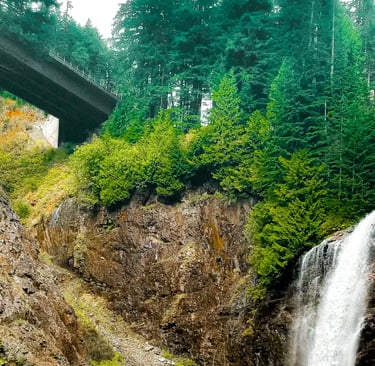
At 3/4 mile in, take an interesting side trail on the right leading to the Snoqualmie Pass Wagon Road. You can still see wheel ruts & debris. See below in the next section.
Plan on 4-7 days total for Part 1-2. Part 1 = Coeur d'Alene, ID to Spokane, WA and Leavenworth, WA. Part 2 = Snoqualmie, WA to Vancouver, WA. FYI: $5/day NW Forest Pass is required. The roads between Hwy 90 NW & SE lanes in Snoqualmie are CLOSED during winter.
Don't forget Pt 1: Intense Theme Park & Feeding Reindeer
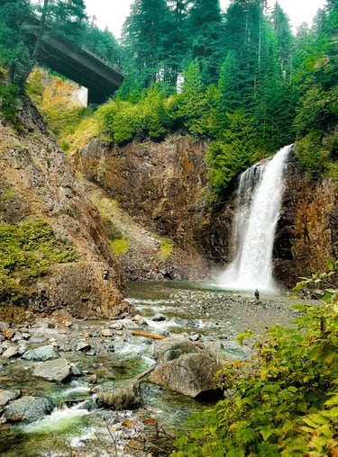
The stone steps (below right) leading down to the falls are super slippery. If the weather's warm, venture out to the pool at the bottom of the falls. Depending on conditions, the pool may be fairly shallow by late summer.
Snoqualmie, Washington
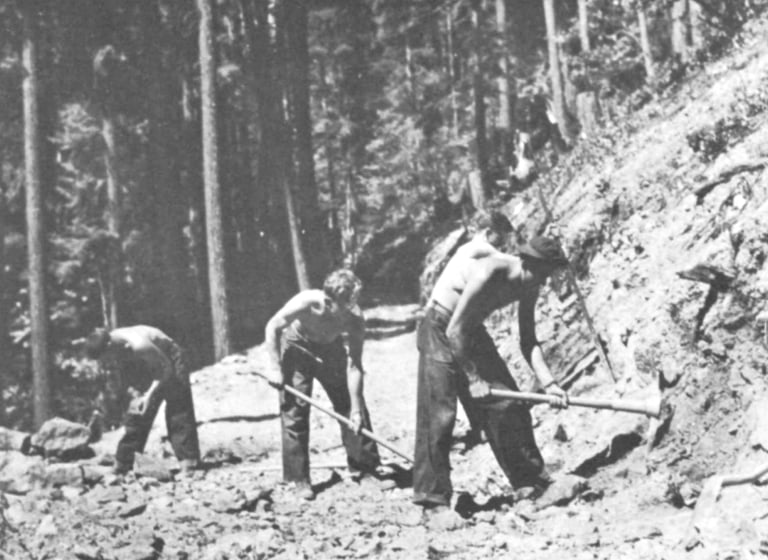
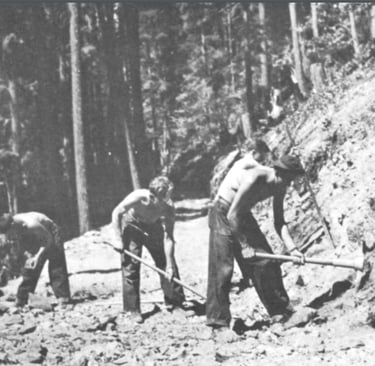
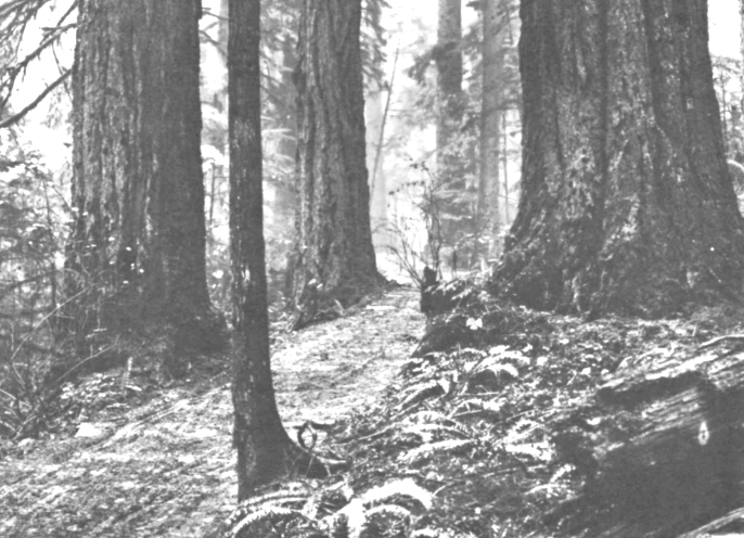
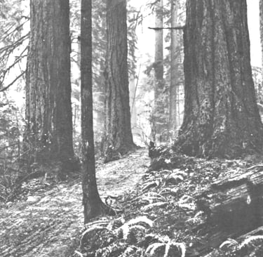
Next to the Franklin Falls trail, is the Snoqualmie Pass wagon road. Seattle started to boom and settlers coming from the east wanted to find a route to get to the west. The Cascade Mountains & Snoqualmie Pass were deemed too dangerous as a possible route having rough mountainous terrain & freezing severe weather - impassable in heavy snow.
With help from Native Americans, the Naches Pass was the first route attempted in 1853. It seemed an impossible journey across the mountain at 4,928 feet elevation. One of the first parties that miraculously made it through reported having to lower a wagon down a 1,000 foot drop by a rope. Knowing the bravery & daunting feats the first pioneers endured - sure makes me grateful for all that horse power under the hood of my SUV.
In 1856, a route for the railroad also became a priority thru Snoqualmie Pass. Travelers learned from Native Americans that there were 2 routes on different elevations: one was a horse trail & one was by foot. Hwy 90 traverses the same route used by foot at 3,015 feet elevation. Finally, the Snoqualmie Wagon Road was completed in 1868 at 2,604 feet elevation, and built for an easier route to the Seattle area. Photos courtesy of U.S. Forest Service.
Mountain Pass Hardships: Wagon Rd
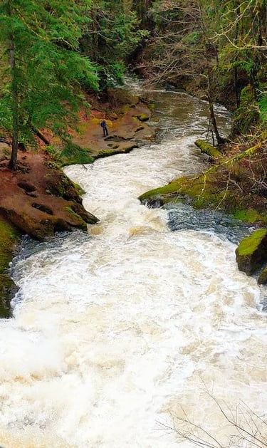
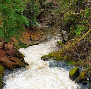
Stay on Moulton Falls Trail, the main trail once you cross the bridge. If you brought lunch, head to the picnic area down the trail to the right. Because the main trail is wide & flat, it's popular for all kinds of activities, like hiking, biking, and horseback riding.
Less than 1 mile from the parking lot, is the Bells Mountain Trail to the left - just in case you wanna add a 16 mile challenging roundtrip trek up & around the mountain. Already been hiking for 4 miles.... so I pretend the trail isn't there and continue on to finish the 5.3 mile hike.
Moulton Falls Trail follows the river & Lucia Falls Rd until it turns into Hantwick Trail - and dead-ends at NE Hantwick Rd. And YAY.....restrooms! It's a gorgeous sunny day, and I'm happy I don't have to make like a bear and pee in the woods! To get back, do it all in reverse.
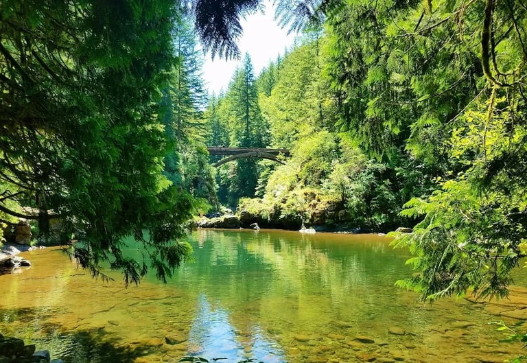
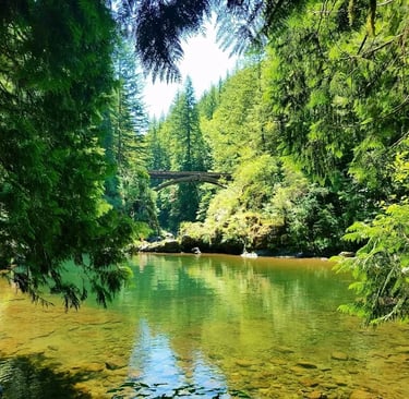
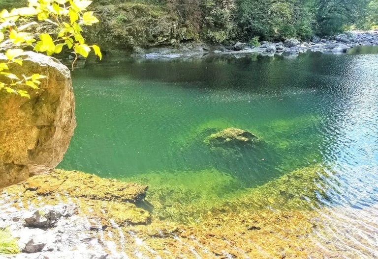
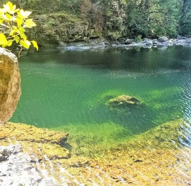
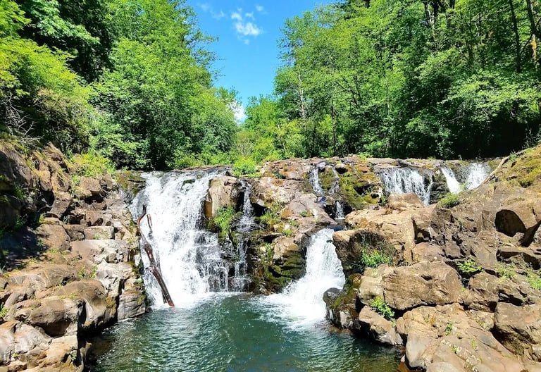
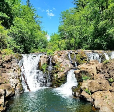
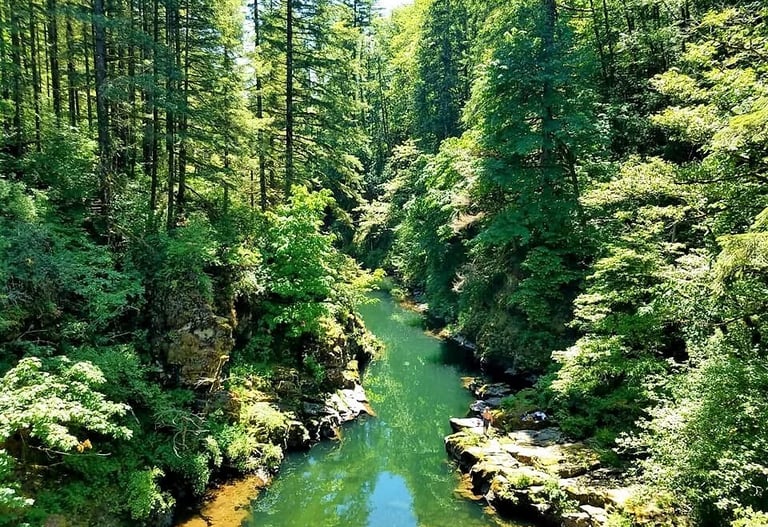
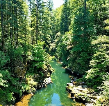
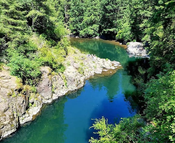
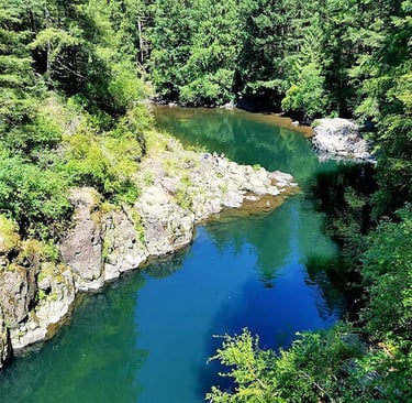
Moulton Falls
Location = Moulton Falls. 27781 NE Lucia Falls Rd, Yacolt WA. The parking lot is just before that on the right. Option: 5.3 mile roundtrip.
Enjoy the drive to Moulton Falls, as the entire stretch of road to the trailhead is beautiful. Follow the trail from the parking lot, and parallel the road until you curve to the right around the river bend to the footbridge. The views are stunning as you gaze down at the Lewis River scenery below, winding it's way toward the Moulton Falls.
Our favorite view is further down E. Fork Lewis River looking back towards Moulton Falls Bridge, bottom left. The foliage frames the storybook looking bridge perfectly. It's easy to imagine you're in inside the pages of that storybook, and the castle is just across the bridge. Wait, stop. Not going down that rabbit hole....because right behind every Prince is a wicked witch looking for something to jack up!
Yacolt ,Washington
Pothole Falls
Location = Pothole Falls. 3344 NE St, Camas WA. This address is to the Park building next to the parking lot off Everett St. More parking - go across the Everett bridge, first right on NE 35th St, then left to parking. Loop trail around Round Lake = 2.5 miles.
FYI: Park maps are at the Kiosk near the playground. The Public Health Dept. issued a warning Oct 2023 about toxic algae in Lacamas Lake, which flows into Round Lake & Pothole Falls.
From Everett St. parking, head south to the right of the building & into the forest. Round Lake will be on your left. The map will come in handy, so you don't miss Pothole Falls. Walk over the dam for a nice view above Pothole Falls. If you explore further you'll understand how it got it's name "pothole". Lacamas River is also pretty as it winds it's way thru the forest.
Continue to follow the lake around to the left. As you near the north end, the trail follows NE 35th to the left. Then go left again beside NE Everett and over the bridge back to the parking lot. It's a nice green oasis on the edge of town.


Camas ,Washington
More Fun Things to Do
Fort Vancouver Historic Park & Officers Row - 22 restored historic homes on a tree lined street, the oldest home was built for Ulysses S. Grant, a Union General & USA President. The Barracks are across the street.
Columbia River Gorge - hike in beautiful forests, with 108 waterfalls. See my blog: Multnomah Falls Heights
Museum of Glass - all things blown glass in stunning colors & artistic moving designs. I collect blown glass art, so I recommend this to all like minded art lovers.
Waterfront Park - stroll the pier, stop for food/drinks, see stylish art designs & an amazing water feature.
Waterfront Renaissance Trail - 5 miles along the river.
Source Climbing Center - indoor rock climbing.
Vancouver ,Washington
Portland, Oregon
Portland is a beautiful city - both for culture and the outdoors, and we prefer it over Vancouver. There's also an added bonus in Oregon - NO sales tax. Take the bridge from Vancouver into Portland for this tour: Troll Patrol & Witches Castle in a Wacky City.
Vacation Travel Tips
Average temps for Coeur d'Alene, Vancouver WA, and the mountain town of Leavenworth, WA: Summer 79-85/50-56 degrees F. Winter 37-48/21-35.
Snowfall avg is 70 inches/yr in Coeur d'Alene per the City.
Snowfall avg is 89 inches/yr in Leavenworth, WA.
Vancouver gets minimal snow. Websites vary greatly in data.
Backpack essentials - water, bug spray, sunscreen, whistle, flashlight, cell phone, pocket knife, camera, and a light jacket for summer.
Winter Essentials - thermal blanket, walking poles, waterproof hiking boots, and winter clothing.
Trails if wet/slippery – get trail tennis shoes or hiking boots.
Higher elevations - temps are colder with more snow.
Vehicle safety – Keep a spare blanket, boots, jacket, gloves, and snacks in the car. Winter roads call for “winter” tires. If you only have "all season" tires, take snow chains.
Wild animals - Elk, moose, deer, black/grizzly bears, mountain lion, coyote, beaver, and muskrat.
Pack out - what you pack in.
Rivers/lakes – Please be mindful of currents & water temps. Winter & spring bring fast currents & frozen waters.
Poisonous Snakes - there are 2 in Idaho & 3 in Washington. They generally avoid humans, but will bite if threatened. Typically not found above 6,000 ft.
Wilderness areas – take a buddy & tell someone your travel plans.

Health & Travel Vibes
USA Based. © 2022. All rights reserved.