

Coast, Oregon Travel - Roller Coaster Ride Up the Coast, Pt 2
2024. Roller coaster ride from beaches to soaring cliffs along 363 miles of Oregon coast. Visit Coos Bay, Reedsport & Florence. See Charleston Marine Center, Mingus Park & Shore Acres. Walk miles on Horsfall Beach, ride Winchester Bay's sand dunes & hike Sweet Creek Falls, A bucket list must.
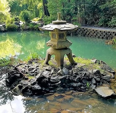
Mingus Park
Location - Mingus Park. Parking is off N. 10th St just south of the 8th Terrace intersection. There's also parking off the west side of N. 10th south of Cedar Ave at the public swimming pool. Mingus Park also has a disc golf in the north woods area and a skate park on the east side of N. 10th St. Restrooms are off N. 10 St by the playground area.
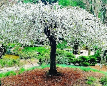
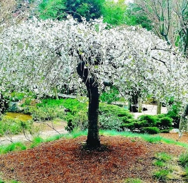
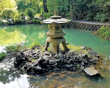
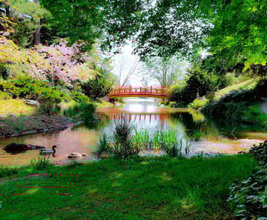
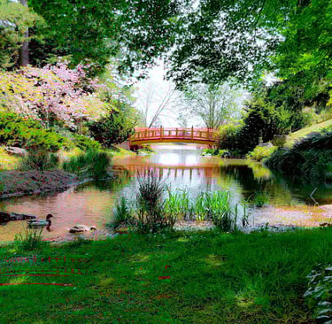
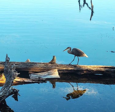
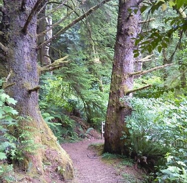
Mingus Park is only about 1 mile around the lake but you can take a couple side trails up the hill and get close to 2 miles in. It's a really nice relaxing and picturesque stroll, especially if you go during the work week. The Japanese gardens at the north end of the lake blend harmoniously with the scenery creating that sense of calm.
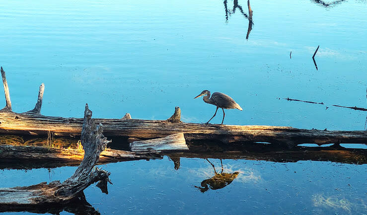
I've also seen quite a few animals & birds - nutria, heron, wild turkeys, and of course loads of ducks. Mingus Park is worth the hour stop to explore, especially when it's alive with flowering plants & trees from May-September.
Coos Bay/North Bend, Oregon
Plan on 8-12 days total for Parts 1-3 on the 363 mile Oregon coast Hwy 101.
Part 1 = Brookings, Gold Beach, Bandon. Part 2 = Coos Bay/North Bend, Winchester Bay, Reedsport, Florence. Part 3 = Waldport, Newport, Depoe Bay, Lincoln City, Canyon Beach, Astoria. Hike the Oregon Coast Trail if you love crazy challenges.
Great add-on trip: Roller Coaster Ride up the Coast, Pt 3
Coos Bay and North Bend are 2 towns that could easily be merged into one, making it the largest community on the Oregon coast. Together, the population is 26,270 in 2022.
Empire Lakes
Location = Empire Lakes. 250 Hull St, Coos Bay OR. FYI: Empires Lakes is also known as John Topits Park.
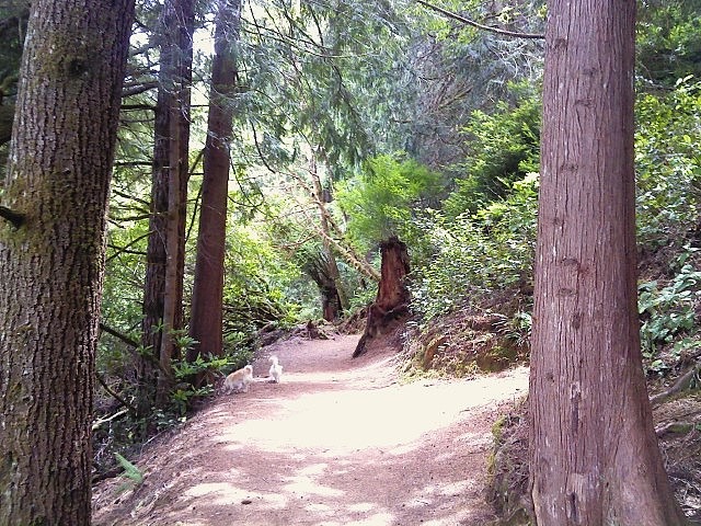
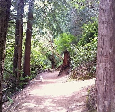
Empire Lakes is a nice wooded park for walking, with small hilly trails around a lake. The main loop goes around the lake with side trails that take you to an outer loop. You can probably get fairly close to 3 miles in, if you weave around and take the side trails. It's a nice little workout if you keep a brisk pace up & down the hilly trails.
Keep your eye out for small rocks about 3 inches long, placed along the trail either on the ground, on top of a big rock, or wedged in the trees. They're painted rocks, and just a nice way to say "hello" by sharing your art with others. Empire Lakes is also great for kayaking, swimming, and fishing (license required).
Location = Charleston Marine Center. 63466 Boat Basin Rd, Coos Bay OR. Cheap entry fee.
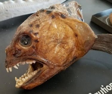
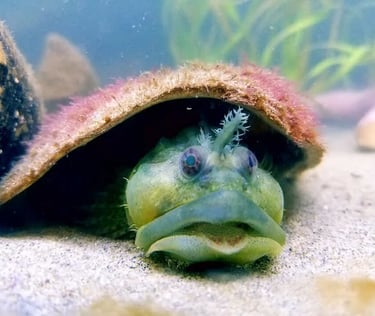
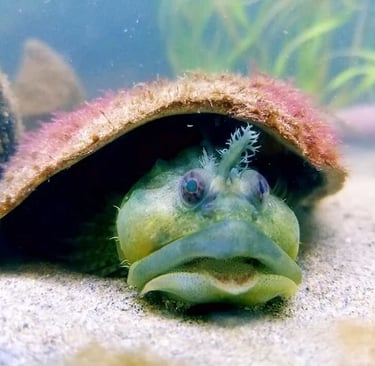
The Charleston Marine Center is a quick 7 miles from Coos Bay - south on the Cape Arago Hwy. The Charleston Marine Center is not a huge facility, but we were fascinated because of the variety of sea creatures we've never seen before, even in big city aquariums.
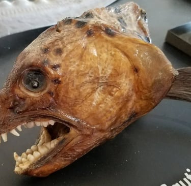
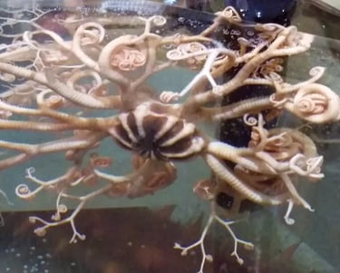
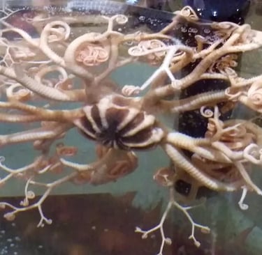
The Charleston Marine Center has plenty of living creatures, as well as those that have been preserved. It's really a fun & educational experience. For instance, seeing a fossil of the familiar seal and the finger bones that make up their flippers. If you want to see bizarre - check out the big round open tank at the entrance to see things like what's pictured bottom right.
If you've got a favorite creature, feel free to share. I was so wrapped up in all the fascinating weirdness and beautiful strangeness - I forgot to find out what some of these guys are.
Charleston Marine Life Center
Location = Shore Acres. 89526 Cape Arago Hwy, Coos Bay OR. $5 parking fee or have an OR Parks & Rec permit or Coastal Pass. There's also several small parking areas past Sunset Beach south to Simpson Reef Outlook. Sunset Bay is a popular surfing spot, and has a golf course.
In 1906, Mr. Simpson built his mansion with indoor swimming pool & a tennis court overlooking the ocean. The mansion has deteriorated except for 2 waist high pillars marking the entrance to their home - it's down the trail next to the Shore Acres' entrance booth.
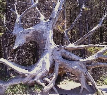
Shore Acres Park runs along the coast, high up the cliffs. I've hiked this trail many times, and always find some new treasure that captures my eye. From Shore Acres Park parking area - hike north about 1/4 mile and you'll find cracked asphalt where Mr. Simpson's tennis court was, and something else amazing.
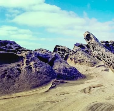
The ocean during high tide, splashes this rugged coastline with such force it has created a large area of shapes like moon-craters - see photo up top.
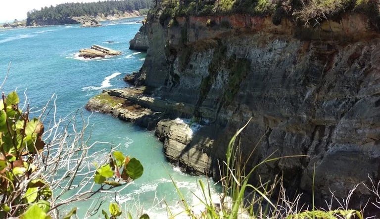
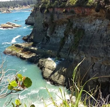
Oregon is mostly an undeveloped coastline, where you can enjoy the strikingly gorgeous scenery. California's is mostly developed - except for the northern coast - stripping nature of her true beauty. Behind the enclosed botanical gardens of Shore Acres is a trail that leads down to a secret beach. It's a perfect little cove to relax & explore cave, tidepools, and rocks. Once, I saw a large seal that having a little siesta (rest), so my dogs and I didn't stick around too long.
At the bottom of the stairs and about 20 feet into sand, look to your left for the continuation of the trail which goes all the way to the parking area for Simpson Reef - it's the best view to see a small island offshore packed with seals/sea lions. Binoculars would really get you up close.
Shore Acres State Park
Location = Horsfall Beach & Dunes. Go north across the North Bend Bridge, left on Trans-Pacific Ln to the Oregon Dune Recreation area and Horsfall Beach. Just past the railroad tracks is the Dune Recreation area where you can rent ATV's or park and ride your own. Just beyond that, go right on Horsfall Beach Rd which dead-ends at the beach.
Horsfall Beach - Beach goers stay on the beach to the left of the parking lot. Motorized vehicles stay on the beach to the right of the parking lot. Motor vehicles are PROHIBITED on the left side of the beach from May thru September.
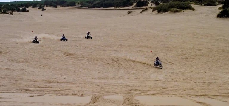
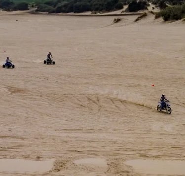
Sand Dunes
Come on, come on all you sand dune lovers. The Horsfall Dune Rec Area is a sand dune paradise, with some sand dunes rising up 500 feet. Choose your vehicle and ride for miles - motorcycles, ATV’s, or dune-buggies. The latter 2 can be rented at the Dune Rec Area here or, there's a few other rental shops between North Bend and Florence.
Horsfall Beach
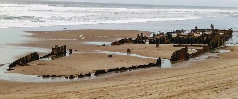
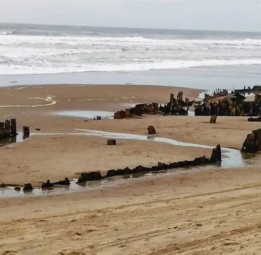
Horsfall Beach is a popular beach area with sand as far as your eye can see. Dog owners - answer me this: why is it most dogs don't like baths but they absolutely LOVE the beach and ocean? It's always a happy trip with my dogs. If you visit Horsfall Beach between mid-Jan thru Feb you might get lucky and see this amazing find. It's a 324 ft. steamship that ran aground in 1929. It rises up from the sand like some magic trick only to disappear again.
Want fewer beach crowds? Stay on Trans-Pacific Ln past Horsfall Beach Rd & drive about 2.5 miles to a pullover area on the right. You'll see a big metal gate with a wide gravel path that heads straight back to the beach. Please help keep the area clean & pack your trash out.


Horsfall Beach & Dune Recreation
Tugman State Park
Location = Tugman Park. 72549 US-101, Lakeside OR. Tugman Park trail is rated moderate for the hill sections.
Tugman Park is about 15 miles north of North Bend and a great park for families. It has a boat launch, campsites, playground, and little beach area perfect to launch yourself and take a swim. Be warned though, the water temperatures are on the cool side even in summer. It's also popular for kayaking, boating & fishing.
Tugman Park also has a 6 mile round-trip hiking trail which winds up and around the side of the mountain. From the parking lot, and looking at the lake, the trail is back towards the water on the right. It's thru a narrow clearing just south of the little beach area. I love this trail - it's a good workout up the dozens of hills as you wind your way towards the top. The trail itself is interesting because it has slight changes in scenery throughout the 3 mile trek up.
FYI: Walk with a partner and be mindful of your surroundings. It's not often, but wild animals like cougar have been spotted up the mountain. They will post signs at the trailhead for any animal spotted within the past few weeks.
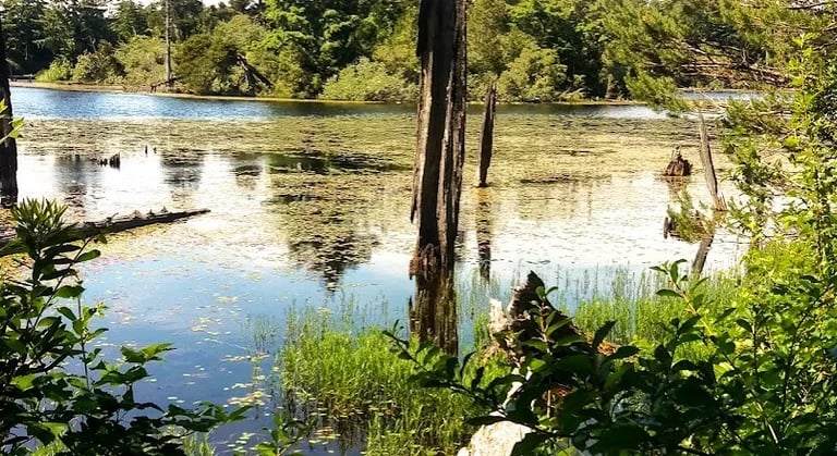
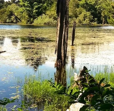
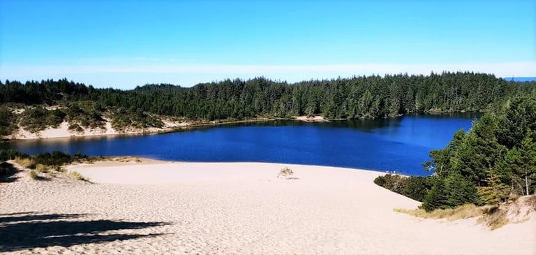
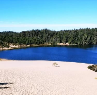
Lake Marie & Umpqua Lighthouse
Location = Lake Marie & Umpqua Lighthouse. 452-682 Lighthouse Rd, Winchester Bay OR.
About 4.5 miles north of Tugman Park or about 18 miles from the North Bend bridge. Lake Marie is a small, tranquil lake that's less crowded and has a surprise twist. From Hwy 101, go left on Lighthouse Rd to the "T" intersection & go left. In a short distance, if you want to see the Umpqua Lighthouse take the road to the left.
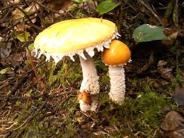
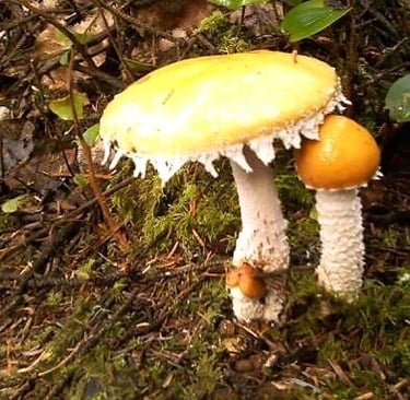
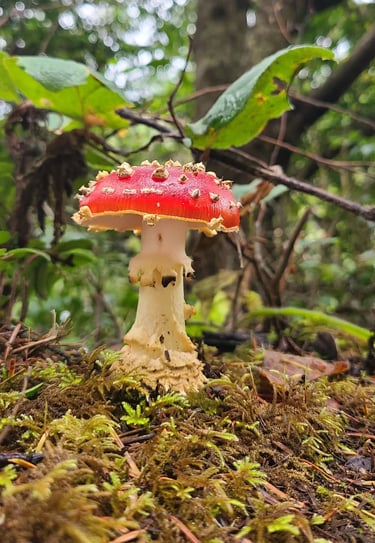
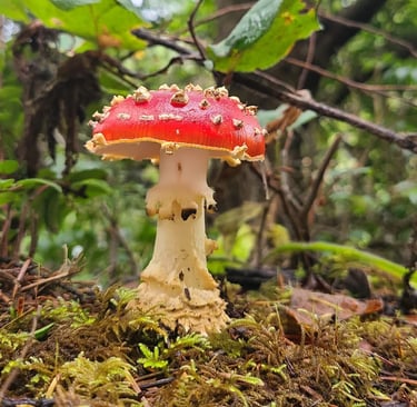
For Lake Marie, stay to the right and you'll quickly see some parking on the left. The loop trail is about 1 mile, up & down small little hills. There's one section half way around, with a little different environment. If you catch it just right, you'll enter a miniature world of skunk cabbage and colorful mushrooms.
Start to the right of the lake and go counter clockwise. After a short 5 minute walk - take the side trail to the right to see the surprising twist. It's only a 15-20 minute detour and you'll enjoy the nice surprise.
Winchester Bay, Oregon
Detour - at the end of the short trail you'll go thru a tunnel. It's just the trees that grew into a tunnel shaped formation. And then.... wha-la.
* Win a prize = Be first to send a pic of you standing in the ? after you go thru the tunnel.
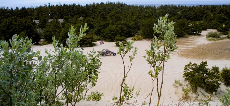
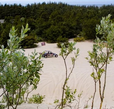
Winchester Bay Sand Dunes
Winchester Bay is about 20 miles north of North Bend and it's a tiny speck of a town known primarily for sand dunes & fishing. From Hwy 101, turn left on Salmon Harbor Dr. Follow it down and you’ll find sand dunes galore with several ATV staging areas on both sides of the road. If you need ATV's - no worries, there's 2 rental places. FYI: Winchester Bay is usually windy - a cold day with lots of wind makes for a super cold day.
After your exhilarating sand dune zoomies are over, stretch your legs on the miles of pristine beaches. We like Beach #2 Day Use area because it's less crowded & has a bathroom. We had an awesome afternoon. After all that sun & fun - who's up for ICE CREAM? Head back towards Hwy 101 - BJ's Ice Cream is left on Beach Blvd, the first dock on the left.
Dean Creek Elk Viewing
Location = Dean Creek Elk Viewing parking lot. 48819 OR Hwy 38, Reedsport OR.
On the north end of Reedsport, the Umpqua River follows Hwy 38, a beautiful section of highway known as a State Scenic Corridor. The Dean Creek Elk viewing area is worth the 3 mile drive on Hwy 38. The Elk live in this area year round which is handy - almost a guarantee. The best times to catch them are in the morning & again in late afternoon.
These particular Elk are the largest of the 4 types in the USA and....they're not not at all camera shy. Once, of of the Elk left the "invisible" boundaries of the Dean Creek Elk viewing area, wanting to cross Hwy 38. Maybe to get to Dean Creek on the other side of the road. Lucky for me, he didn't attempt to dart across in the pitch black of night. DANG.... that was a really big dude.
FYI: the Elk are protected, so no hunting. The Umpqua River and scenic OR-38 scenic corridor are just gorgeous so look for the various viewing turnouts. There are boat launch in Reedsport or Scottsburg County Park past the Dean Creek Elk Viewing area.


Reedsport, Oregon
Cleawox Lake
Location = Cleawox Lake & Day Use Area. Head north from Reedsport, and enjoy the views. Just past Siltcoos Lake & Dunes City (barely a blip) is on the right, you'll see Canary Rd on the right, but go left into Cleawox Day Use Area. At the "Y" intersection, go right into the parking lot.
From the Cleawox Lake Day Use parking - there's an easy walking trail starting by the bathrooms that heads east along the shore. You can see to the sand dune hill & beach area to the southwest. The sand has been moving about 15+ feet every year and shrinking the lake. In the summer, the dunes are full of sandboarders, swimmers, and kayakers. It's still a nice place to park it for a while and enjoy the sunshine.
We went mid-week, so we were practically alone. Thank goodness, because my dogs ran across every inch of sand along the water line. They just love the beaches. Despite my daughter's dog Chloe who enjoys a little verbalization (i.e. barking) to let everyone know how happy she is - Cleawox Lake can be a really serene spot. Isn't it obvious - I'm an outdoor lover and if it includes beautiful forests, mountains, and water - I'm in heaven.
Florence, Oregon
Across the bridge into Florence, visit the Old Historic downtown area. It’s charming and filled with unique shops & some delish seafood & Mexican options. Be careful around the dock areas, the seals take advantage and like to lounge in the sun, and you never know if one might get a little territorial.
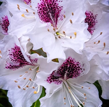
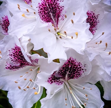
The Rhododendron Festival is the 3rd weekend in May. This flowering tree comes in a variety of colors and is native to Oregon, photo above. In Florence, the Siuslaw River is usually buzzing with people fishing & boating. If you like horses like I do, then what could be more fun than riding horses on the beach? For experienced riders - at full galloping speed you get the feeling you're flying. Awesome. C&M Stables is about 8.6 miles north of the Florence bridge.
Location = Sweet Creek Falls trail. Sweet Creek Rd, Mapleton OR. From Florence take Hwy 126 west, right at Mapleton. From here it's about 11 miles to the trailhead. Take the 1st right on Sweet Creek Rd and drive about 30 minutes. There's a yellow & brown sign at the driveway on the right to parking.
Sweet Creek Falls trail is 2.2 mile roundtrip with a few smaller waterfalls. But the scenery is simply dazzling and the creek follows the trail up a gentle incline. Sweet Creek Falls won't blow your mind, but the gorgeousness of the area will. The trail itself is not your ordinary hiking trail. There's several really interesting and unexpected surprises - like a wire mesh section of trail that's bolted to the side of a huge rock wall.
You can get lost in Sweet Creek Falls - not physically lost but mentally. Your worries will quickly melt away as you admire and absorb the beauty. And even the though the waters of Sweet Creek are splashing & rushing past - you feel in awe and at peace. Note: my camera was stolen in the middle of nowhere, so I had to use an old phone - the pictures do NOT capture the beauty of Sweet Creek Falls.
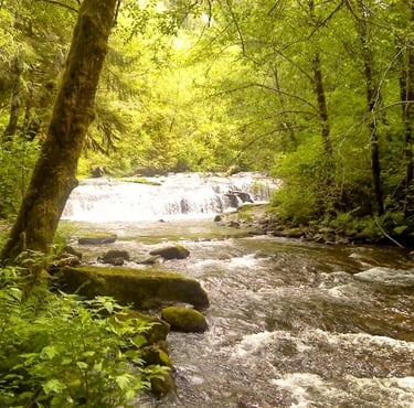
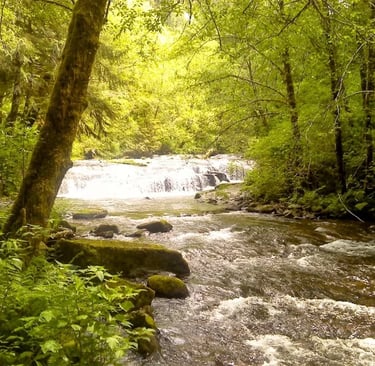
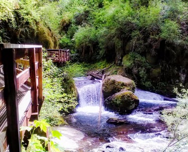
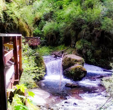

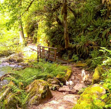
Sweet Creek Falls
Sea Lion Caves
Location = Sea Lion Caves. 91560 Hwy 101 N, Florence OR. It's about 10 miles north of Florence & parking is on the right. It’s basically a short walk down to a large cave with penguins everywhere. Wait, Penguins.... ha, just wanted to see if you were paying attention. LOL. They're sea lions. We didn’t think it was worth it - but you might find it interesting.
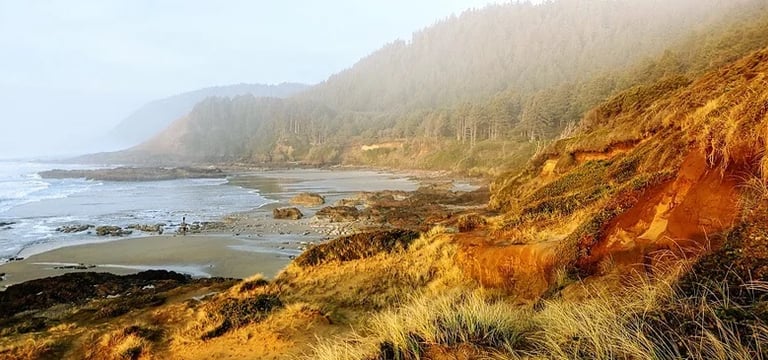
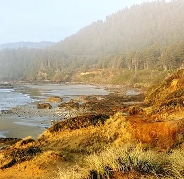
Strawberry Hill Wayside
Location = Strawberry Hill. 95720-95744 Hwy 101, Florence OR.
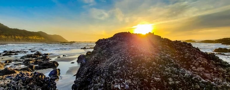
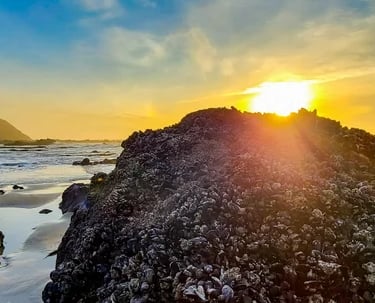
9.8 miles north of Sea Lion Caves is Strawberry Hill, another stop with hidden surprises. It's a great spot to view the seals working on their suntans. Who needs Sea Lion Caves, you can see them here. They're hanging out on the rocks back by the ocean waves.
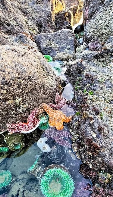
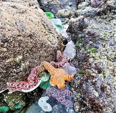
Kids of all ages will find the tidepools both educational and amusing. Strawberry Hill has an abundance of colorful slimy looking things & other living sea creatures that are scattered throughout the long sandy channel between the rocks. The starfish are amazing in all their bright colors. The whole Strawberry Hill Wayside has a striking landscape because of the contrasting colors - picture green trees as a backdrop with burnt orange earth against a sparkling blue ocean.
Vacation Travel Tips
Average temps high/low = Summer 68/51 degrees F. Winter 53/40. Summer may get some rain. Winter rarely snows. It's usually windy, and adds a chill in winter.
There are a few places that require a “pass” or $5 cash.
Backpack essentials - water, bug spray, sunscreen, whistle, flashlight, cell phone, pocket knife, camera, and a light jacket for summer.
Winter Essentials - waterproof hiking boots, and warm clothing.
Hiking conditions - trails can be wet & slippery even in summer.
Vehicle safety – keep a spare blanket, boots, jacket, gloves, and snacks in the car. All season tires are sufficient even if it's icy a few days.
Wild animals - rarely seen on trails, but they're out there.
Trash - pack out what you pack in.
Rivers/lakes – river shoes are a must. Be mindful of currents & water temps. Heavy winter rains/snow means cold, deep & fast moving water. Most coastal cities are next to large rivers that flow into the Pacific Ocean.
Rattlesnakes - not usually found above 6,000 ft.
Wilderness areas – take a buddy & tell someone your travel plans.
Tourist season - Due to the small town coastal culture, tourist season brings heavy traffic, including motorhomes on single lane roads. Locals from inland areas also come for fishing, camping, and sand-dunes in the summer & on holidays, so parking may be limited.
Poison oak - Not on the coast, but is found 30-40 min. drive inland.
Snakes - mainly garter snakes on the coast.
Wilderness areas – take a buddy & tell someone your travel plans.

